Fog Report(s)
As reported from LAKE CHARLES/MUN., LA.
(30 07N 93 12W 5m)
UNITED STATES OF AMERICA
Fog reported at 12 UTC 25 Sep 2013
(Fog or ice fog in patches)
Visibility: 800m
Fog Report(s)
As reported from JACKSON/ALLEN C. THOMPSON FIELD, MS.
(32 19N 90 04W 91m)
UNITED STATES OF AMERICA
Fog reported at 12 UTC 25 Sep 2013
(Fog or ice fog in patches)
Visibility: 800m
Fog Report(s)
As reported from JACKSONVILLE/INTNL., FL.
(30 29N 81 42W 11m)
UNITED STATES OF AMERICA
Fog reported at 12 UTC 25 Sep 2013
(Fog or ice fog in patches)
Visibility: 800m
Fog Report(s)
As reported from COLUMBIA/REGIONAL, MO.
(38 49N 92 13W 274m)
UNITED STATES OF AMERICA
Fog reported at 12 UTC 25 Sep 2013
(Fog or ice fog in patches)
Visibility: 400m
Fog Report(s)
As reported from GRAND ISLAND/GR. IS. COUNTY, NE.
(40 57N 98 19W 566m)
UNITED STATES OF AMERICA
Fog reported at 12 UTC 25 Sep 2013
(Fog or ice fog in patches)
Visibility: 800m
Fog Report(s)
As reported from CHARLESTON/KANAWHA., WV.
(38 22N 81 36W 299m)
UNITED STATES OF AMERICA
Fog reported at 12 UTC 25 Sep 2013
(Fog or ice fog in patches)
Visibility: 400m
Fog Report(s)
As reported from WILLIAMSPORT/LYCOMING COUNTY, PA.
(41 15N 76 55W 160m)
UNITED STATES OF AMERICA
Fog reported at 12 UTC 25 Sep 2013
(Fog or ice fog in patches)
Visibility: 800m
Fog Report(s)
As reported from SIOUX CITY/MUN., IA.
(42 24N 96 23W 336m)
UNITED STATES OF AMERICA
Fog reported at 12 UTC 25 Sep 2013
(Fog or ice fog in patches)
Visibility: 400m
Fog Report(s)
As reported from GREEN BAY/A.-STRAUBEL, WI.
(44 29N 88 06W 209m)
UNITED STATES OF AMERICA
Fog reported at 12 UTC 25 Sep 2013
(Fog or ice fog in patches)
Visibility: 400m
Fog Report(s)
As reported from DULUTH/INT., MN.
(46 50N 92 11W 432m)
UNITED STATES OF AMERICA
Fog reported at 12 UTC 25 Sep 2013
(Fog or ice fog in patches)
Visibility: 200m
Thunderstorms Report(s)
As reported from WEST PALM BEACH/ INT. FL.
(26.68N 80.10W 6m)
UNITED STATES OF AMERICA
Thunderstorm as at 18 UTC 24 Sep 2013
(Slight or moderate thunderstorm without hail)
Heavy Rain/Snow Report(s)
As reported from JACKSON/ALLEN C. THOMPSON FIELD, MS.
(32 19N 90 04W 91m)
UNITED STATES OF AMERICA
Heavy Rain/Snow
(Rainfall/Snowfall was 54.4 mm in the past 24 hours ending at 12 UTC
25 Sep 2013)
Heavy Rain/Snow Report(s)
As reported from APALACHICOLA/MUN., FL.
(29 44N 85 02W 6m)
UNITED STATES OF AMERICA
Heavy Rain/Snow
(Rainfall/Snowfall was 57.3 mm in the past 24 hours ending at 18 UTC
25 Sep 2013)
CCODE/1:31:12:01:00/AOW+POR/NWS/CCODE
SUPERSEDED BY NEXT ISSUANCE IN 6 HOURS
SEAS GIVEN AS SIGNIFICANT WAVE HEIGHT...WHICH IS THE AVERAGE
HEIGHT OF THE HIGHEST 1/3 OF THE WAVES. INDIVIDUAL WAVES MAY
BE MORE THAN TWICE THE SIGNIFICANT WAVE HEIGHT.
SECURITE
PACIFIC N OF 30N AND S OF 67N E OF A LINE FROM BERING STRAIT
TO 50N 160E
SYNOPSIS VALID 1200 UTC SEP 25.
24 HOUR FORECAST VALID 1200 UTC SEP 26.
48 HOUR FORECAST VALID 1200 UTC SEP 27.
.WARNINGS.
...STORM WARNING...
.24 HOUR FORECAST LOW 56N179E 994 MB WITH A FRONT FROM CENTER TO
46N160E. WITHIN 660 NM S QUADRANT AND ELSEWHERE WITHIN 360 NM S
AND SE OF THE FRONT WINDS 25 TO 40 KT. SEAS 12 TO 20 FT.
.48 HOUR FORECAST LOW 58N159W 971 MB. WITHIN 240 NM SW AND S
QUADRANTS AND WITHIN 240 NM E AND SE OF A FRONT FROM 51N151W TO
50N158W WINDS 40 TO 50 KT. SEAS 15 TO 25 FT. ELSEWHERE WITHIN
840 NM S AND 360 NM N SEMICIRCLES WINDS 25 TO 40 KT. SEAS 8 TO
17 FT.
...STORM WARNING...
.48 HOUR FORECAST POST-TROPICAL PABUK W OF FORECAST AREA NEAR
44N158E 987 MB. OVER FORECAST WATERS WITHIN 180 NM SE QUADRANT
WINDS 35 TO 50 KT. SEAS 18 TO 28 FT. ELSEWHERE FROM 39N TO 50N W
OF 174E WINDS 25 TO 35 KT. SEAS 10 TO 19 FT.
...GALE WARNING...
.LOW 57N166W 976 MB MOVING E 20 KT. OVER FORECAST WATERS WITHIN
660 NM SE SEMICIRCLE AND WITHIN 420 NM NW AND W QUADRANTS WINDS
25 TO 40 KT. SEAS 12 TO 22 FT...HIGHEST OVER S QUADRANT.
.24 HOUR FORECAST LOW 58N150W 998 MB. WITHIN 540 NM S AND 360 NM
W QUADRANTS WINDS 25 TO 35 KT. SEAS 8 TO 16 FT.
.48 HOUR FORECAST LOW DISSIPATED WITH CONDITIONS DESCRIBED WITH
LOW 58N159W NOTED ABOVE.
...GALE WARNING...
.LOW NW OF FORECAST AREA NEAR 57N166E 998 MB MOVING NE 15 KT.
OVER FORECAST WATERS N OF A LINE FROM 43N160E TO 47N174E WINDS
25 TO 35 KT. SEAS 8 TO 13 FT.
.24 HOUR FORECAST LOW 60N175E 989 MB. BETWEEN 180 NM AND 420 NM
E QUADRANT WINDS 20 TO 30 KT. SEAS TO 9 FT.
.48 HOUR FORECAST LOW ABSORBED BY LOW 58N159W NOTED ABOVE.
...GALE WARNING...
.FROM 30N TO 38N BETWEEN 119W AND 126W AREA OF N TO NW WINDS 20
TO 30 KT. SEAS 8 TO 12 FT.
.24 HOUR FORECAST FROM 33N TO 39N BETWEEN 120W AND 125W N TO NW
WINDS 25 TO 35 KT. SEAS 11 TO 16 FT. ELSEWHERE FROM 30N TO 42N
BETWEEN 118W AND 129W N TO NW WINDS TO 25 KT. SEAS 8 TO 12 FT.
.48 HOUR FORECAST FROM 31N TO 41N BETWEEN 120W AND 128W N TO NW
WINDS 20 TO 30 KT. SEAS 8 TO 13 FT.
...GALE WARNING...
.OVER FORECAST WATERS W OF A LINE FROM 30N176E TO 38N174W AREA
OF WINDS 20 TO 30 KT. SEAS 8 TO 12 FT.
.12 HOUR FORECAST FROM 30N TO 37N BETWEEN 165E AND 179E WINDS 25
TO 35 KT. SEAS 9 TO 15 FT.
.24 HOUR FORECAST FROM 30N TO 36N BETWEEN 164E AND 176E WINDS 25
TO 35 KT. SEAS 9 TO 15 FT. ELSEWHERE W OF A LINE FROM 30N169W TO
40N157W WINDS TO 25 KT. SEAS TO 10 FT.
.48 HOUR FORECAST W OF A LINE FROM 30N168W TO 38N159W TO 176E
WINDS 20 TO 30 KT. SEAS 8 TO 13 FT.
.SYNOPSIS AND FORECAST.
.FROM 38N TO 50N BETWEEN 126W AND 135W AREA OF N TO NW WINDS TO
25 KT. SEAS 10 TO 14 FT.
.24 HOUR FORECAST FROM 39N TO 49N E OF 130W N TO NW WINDS TO 25
KT. SEAS TO 10 FT.
.48 HOUR FORECAST CONDITIONS DIMINISHED.
.DENSE FOG. VSBY OCCASIONALLY LESS THAN 1 NM FROM 42N TO 59N
BETWEEN 143W AND 155W AND OVER FORECAST WATERS N OF 46N AND W OF
174E.
.24 HOUR FORECAST DENSE FOG FROM 44N TO 54N BETWEEN 135W AND
144W AND WITHIN 360 NM S AND SE OF A LINE FROM 57N176W TO
50N167E TO 47N160E.
.48 HOUR FORECAST DENSE FOG WITHIN 540 NM S AND SE OF A LINE
FROM 52N177W TO 47N160E.
.HIGH 39N149W 1031 MB NEARLY STATIONARY.
.24 HOUR FORECAST HIGH 40N145W 1028 MB.
.48 HOUR FORECAST HIGH 38N138W 1027 MB.
.HIGH 41N177E 1032 MB MOVING E 30 KT.
.24 HOUR FORECAST HIGH 42N174W 1036 MB.
.48 HOUR FORECAST HIGH 41N172W 1034 MB.
.FORECASTER VUKITS. OCEAN PREDICTION CENTER.
NATIONAL HURRICANE CENTER MIAMI FL
E PACIFIC FROM THE EQUATOR TO 30N E OF 140W.
SYNOPSIS VALID 1200 UTC WED SEP 25.
24 HOUR FORECAST VALID 1200 UTC THU SEP 26.
48 HOUR FORECAST VALID 1200 UTC FRI SEP 27.
.WARNINGS.
.NONE.
.SYNOPSIS AND FORECAST.
.NW OF A LINE FROM 29N115W TO 23N125W TO 21N140W WINDS 20 KT OR
LESS. SEAS 8 TO 10 FT IN NW SWELL...EXCEPT 10 TO 11 FT N OF 26N
BETWEEN 120W AND 130W.
.24 HOUR FORECAST N OF 29N BETWEEN 118W AND 125W NW TO N WINDS
20 TO 25 KT. SEAS 10 TO 12 FT IN NW SWELL. ELSEWHERE N OF A LINE
FROM 30N116W TO 15N120W TO 22N135W TO 27N140W WINDS 20 KT OR
LESS. SEAS 8 TO 10 FT IN NW SWELL...HIGHEST N OF 26N E OF 125W.
.48 HOUR FORECAST WITHIN AN AREA BOUNDED BY A LINE FROM 30N117W
TO 10N115W TO 07N127W TO 30N130W TO 30N117W WINDS 20 KT OR LESS.
SEAS 8 TO 10 FT IN NW SWELL...HIGHEST N OF 27N BETWEEN 118W AND
126W.
.LOW PRES NEAR 14N123W 1009 MB DRIFTING NE. WITHIN 120 NM NW
QUADRANT WINDS 20 TO 25 KT. SEAS TO 9 FT. WITHIN 120 SE QUADRANT
WINDS 20 KT OR LESS. SEAS TO 8 FT IN MERGING SE AND NW SWELL.
.24 HOUR FORECAST LOW PRES NEAR 14N121W 1008 MB. WITHIN 120 NM
SE SEMICIRCLE WINDS 20 KT OR LESS. SEAS 8 FT IN PRIMARILY NW
SWELL.
.48 HOUR FORECAST LOW PRES DISSIPATED. CONDITIONS MERGE WITH
AREA
ABOVE.
.S OF A LINE FROM 00N110W TO 05N125W TO 05N140W WINDS 20 KT OR
LESS. SEAS TO 9 FT IN MIXED SE AND NW SWELL.
.24 HOUR FORECAST S OF A LINE FROM 00N110W TO 06N125W TO 04N140W
WINDS 20 KT OR LESS. SEAS TO 9 FT PRIMARILY IN SE SWELL.
.48 HOUR FORECAST S OF 07N BETWEEN 115W AND 130W. WINDS 20 KT OR
LESS. SEAS TO 9 FT IN MERGING SE AND NW SWELL.
.REMAINDER OF AREA WINDS 20 KT OR LESS. SEAS LESS THAN 8 FT.
CONVECTION VALID 1430 UTC WED SEP 25...
.LOW PRES NEAR 15N98W 1007 MB...SCATTERED STRONG N OF 14N
BETWEEN 101W AND 104W...AND ELSEWHERE WITHIN 90 NM OF THE COAST
OF MEXICO BETWEEN 104W AND 107W.
.INTERTROPICAL CONVERGENCE ZONE/MONSOON TROUGH...
MONSOON TROUGH AXIS FROM 08N82W TO LOW PRES NEAR 15N98W 1007 MB
TO LOW PRES NEAR 13N115W 1010 MB TO LOW PRES NEAR 14N123W 1009
MB TO 09N140W. SCATTERED MODERATE TO STRONG WITHIN 150 NM N OF
MONSOON TROUGH BETWEEN 82W AND 89W.
.FORECASTER COBB. NATIONAL HURRICANE CENTER.
NATIONAL WEATHER SERVICE HONOLULU HI
NORTH PACIFIC EQUATOR TO 30N BETWEEN 140W AND 160E
SYNOPSIS VALID 1200 UTC SEP 25 2013.
24 HOUR FORECAST VALID 1200 UTC SEP 26 2013.
48 HOUR FORECAST VALID 1200 UTC SEP 27 2013.
.WARNINGS.
.NONE.
.SYNOPSIS AND FORECAST.
.LOW 27N174E 1009 MB MOVING N SLOWLY. TROUGHS FROM LOW TO
30N176E... AND FROM LOW TO 23N168E TO 18N160E NEARLY STATIONARY.
WINDS 20 TO 30 KT OVER FORECAST WATERS W OF LOW AND TROUGHS N OF
27N. ALSO...WINDS 20 TO 25 KT WITHIN 150 NM E QUADRANT OF LOW.
SCATTERED MODERATE TSTMS N OF 24N BETWEEN 179E AND 172E...AND
ELSEWHERE WITHIN 180 NM OF TROUGH S OF 24N.
.24 HOUR FORECAST LOW DISSIPATED. TROUGH FROM 30N173E TO 27N167E
TO 23N160E. WINDS 20 TO 30 KT OVER FORECAST WATERS N OF A LINE
FROM 26N176E TO 26N175E TO 28N174E TO 30N169E.
.48 HOUR FORECAST TROUGH FROM 30N161E TO 24N160E TO 21N161E TO
17N160E. WINDS DIMINISHED TO 20 KT OR LESS.
.TROUGH FROM 14N163E TO 07N161E MOVING W SLOWLY. SCATTERED
MODERATE TSTMS FROM 02N TO 15N W OF 173E.
.24 HOUR FORECAST TROUGH MOVED W OF FORECAST AREA.
.RIDGE FROM 30N168W TO 20N180E TO 12N171E NEARLY STATIONARY.
.OTHERWISE...WINDS 20 KT OR LESS OVER REMAINDER OF FORECAST
AREA.
.SEAS 8 TO 10 FT N OF 26N W OF 174E.
.24 HOUR FORECAST SEAS 8 TO 12 FT N OF A LINE FROM 30N178E TO
27N176E TO 25N160E.
.48 HOUR FORECAST SEAS 8 TO 12 FT N OF 17N W OF 166E.
.OTHERWISE...SEAS 8 FT OR LESS OVER REMAINDER OF FORECAST AREA.
.MONSOON TROUGH FROM 09N140W TO 07N153W. SCATTERED TO LOCALLY
NUMEROUS MODERATE TO STRONG TSTMS WITHIN 210 NM OF MONSOON
TROUGH.
.ITCZ FROM 06N158W TO 06N180E TO 05N171E. ISOLATED MODERATE TO
LOCALLY STRONG TSTMS WITHIN 210 NM OF ITCZ E OF 173E.
HIGH SEAS FORECAST FOR METAREA IV...CORRECTION
NWS OCEAN PREDICTION CENTER WASHINGTON DC
2230 UTC WED SEP 25 2013
CCODE/1:31:04:01:00/AOW/NWS/CCODE
SUPERSEDED BY NEXT ISSUANCE IN 6 HOURS
SEAS GIVEN AS SIGNIFICANT WAVE HEIGHT...WHICH IS THE AVERAGE
HEIGHT OF THE HIGHEST 1/3 OF THE WAVES. INDIVIDUAL WAVES MAY
BE MORE THAN TWICE THE SIGNIFICANT WAVE HEIGHT
SECURITE
NORTH ATLANTIC NORTH OF 31N TO 67N AND WEST OF 35W
SYNOPSIS VALID 1800 UTC SEP 25
24 HOUR FORECAST VALID 1800 UTC SEP 26
48 HOUR FORECAST VALID 1800 UTC SEP 27
.WARNINGS.
...GALE WARNING...
.COMPLEX LOW WITH FIRST CENTER 44N58W 1003 MB NEARLY STATIONARY
AND SECOND CENTER 46N60W 1004 MB MOVING SE 10 KT. WITHIN 480 NM
SW QUADRANT OF SECOND CENTER AND 360 NM N AND NW QUADRANTS OF
FIRST CENTER WINDS TO 25 KT. SEAS TO 8 FT.
.24 HOUR FORECAST COMPLEX LOW WITH FIRST CENTER 44N56W 1000 MB
AND SECOND CENTER 46N53W 1000 MB. WITHIN 420 NM NW QUADRANT OF
SECOND CENTER WINDS 25 TO 35 KT. SEAS 8 TO 12 FT. ELSEWHERE
WITHIN 300 NM SW SEMICIRCLE OF FIRST CENTER AND 540 NM NW
SEMICIRCLE OF SECOND CENTER WINDS 20 TO 30 KT. SEAS TO 10 FT.
.48 HOUR FORECAST LOW 47N48W 996 MB. WITHIN 540 NM NW SEMICIRCLE
WINDS 25 TO 40 KT. SEAS 10 TO 17 FT. ELSEWHERE WITHIN 480 NM SE
SEMICIRCLE WINDS 20 TO 30 KT. SEAS TO 10 FT.
.SYNOPSIS AND FORECAST.
.LOW 46N49W 1004 MB MOVING NE 10 KT. WITHIN 240 NM NE SEMICIRCLE
WINDS TO 25 KT. SEAS TO 9 FT.
.24 HOUR FORECAST LOW DISSIPATED AND CONDITIONS DIMINISHED.
.LOW E OF AREA 44N24W 988 MB MOVING E 10 KT. WITHIN 600 NM W AND
NW AND 960 NM S QUADRANTS WINDS TO 25 KT. SEAS TO 10 FT.
.24 HOUR FORECAST CONDITIONS E OF AREA.
.24 HOUR FORECAST LOW 31N65W 1007 MB. WITHIN 180 NM N SEMICIRCLE
WINDS TO 25 KT. SEAS TO 8 FT.
.48 HOUR FORECAST LOW 35N50W 1005 MB. WITHIN 360 NM E OF A FRONT
FROM 37N44W TO LOW CENTER TO 31N60W WINDS 20 TO 30 KT. SEAS 8 TO
14 FT.
.48 HOUR FORECAST FROM 31N TO 35N AND W OF 70W AREA OF NE WINDS
TO 25 KT. SEAS TO 9 FT.
.DENSE FOG. VSBY LESS THAN 1 NM WITHIN 660 NM NW OF A LINE FROM
45N48W TO 52N35W.
.24 HOUR FORECAST DENSE FOG WITHIN 360 NM NW OF A LINE FROM
45N47W TO 52N35W.
.48 HOUR FORECAST DENSE FOG FROM 46N TO 54N BETWEEN 35W AND 46W.
.HIGH 60N58W 1024 MB MOVING S 10 KT.
.24 HOUR FORECAST HIGH 56N58W 1023 MB.
.48 HOUR FORECAST HIGH 54N56W 1018 MB.
.FORECASTER ACHORN. OCEAN PREDICTION CENTER.
NATIONAL HURRICANE CENTER MIAMI FL
ATLANTIC FROM 07N TO 31N W OF 35W INCLUDING CARIBBEAN SEA AND
GULF OF MEXICO
SYNOPSIS VALID 1800 UTC WED SEP 25.
24 HOUR FORECAST VALID 1800 UTC THU SEP 26.
48 HOUR FORECAST VALID 1800 UTC FRI SEP 27.
.WARNINGS.
.NONE.
.SYNOPSIS AND FORECAST.
.ATLC COLD FRONT 31N60W TO 25N67W. N OF 28N E OF FRONT TO 55W SW
WINDS 20 TO 25 KT. SEAS LESS THAN 8 FT.
.12 HOUR FORECAST LOW PRES NEAR 31N71W 1006 MB WITH COLD FRONT
TO 30N74W TO 29N81W. N OF 27N E OF FRONT BETWEEN 68W AND 77W SW
TO W WINDS 20 TO 25 KT. SEAS TO 9 FT.
.24 HOUR FORECAST LOW PRES NEAR 31N66W 1004 MB WITH COLD FRONT
TO 29N70W TO 30N79W. N OF 26N E OF FRONT BETWEEN 62W AND 72W SW
TO W WINDS 20 TO 30 KT. SEAS 8 TO 11 FT. N OF 27N BETWEEN 54W
AND 62W SW WINDS 20 TO 25 KT. SEAS TO 8 FT.
.36 HOUR FORECAST LOW PRES N OF AREA. COLD FRONT FROM 31N62W TO
28N73W. E OF FRONT AND N OF LINE FROM 31N46W TO 27N55W TO 26N68W
SW WINDS 20 TO 30 KT. SEAS 8 TO 12 FT...HIGHEST NEAR 30N62W.
.48 HOUR FORECAST COLD FRONT 31N58W TO 27N65W THEN STATIONARY TO
LOW PRES NEAR 28N74W. E OF FRONT AND N OF LINE FROM 31N44W TO
27.5N55W TO 26N65W SW WINDS 20 TO 30 KT. SEAS 9 TO 13 FT...
HIGHEST N OF 28N WITHIN 90 NM SE OF FRONT.
.ATLC TROPICAL WAVE ALONG 39W S OF 18N. FROM 15N TO 18N E OF 39W
WINDS 20 KT OR LESS. SEAS TO 8 FT IN MIXED N AND E SWELL.
.24 HOUR FORECAST TROPICAL WAVE ALONG 43W S OF 19N. FROM 12N TO
19N BETWEEN 37W AND 43W WINDS 20 KT OR LESS. SEAS TO 8 FT
PRIMARILY IN N SWELL.
.48 HOUR FORECAST TROPICAL WAVE ALONG 49W S OF 19N. FROM 16N TO
19N BETWEEN 47W AND 49W WINDS 20 KT OR LESS. SEAS TO 8 FT
PRIMARILY IN N SWELL.
.CARIBBEAN FROM 12N TO 15N BETWEEN 70W AND 76W E WINDS 20
TO 25 KT. SEAS TO 8 FT.
.06 HOUR FORECAST WINDS 20 KT OR LESS. SEAS LESS THAN 8 FT.
.REMAINDER OF AREA WINDS 20 KT OR LESS. SEAS LESS THAN 8 FT.
CCODE/1:31:16:01:00/AOW/NWS/CCODE
HIGH SEAS FORECAST FOR METAREA XVI
NWS NATIONAL HURRICANE CENTER MIAMI FL
2315 UTC WED SEP 25 2013
SUPERSEDED BY NEXT ISSUANCE IN 6 HOURS
SEAS GIVEN AS SIGNIFICANT WAVE HEIGHT...WHICH IS THE
AVERAGE HEIGHT OF THE HIGHEST 1/3 OF THE WAVES. INDIVIDUAL
WAVES MAY BE MORE THAN TWICE THE SIGNIFICANT WAVE HEIGHT.
SECURITE
S PACIFIC FROM THE EQUATOR TO 18.5S E OF 120W.
SYNOPSIS VALID 1800 UTC WED SEP 25.
24 HOUR FORECAST VALID 1800 UTC THU SEP 26.
48 HOUR FORECAST VALID 1800 UTC FRI SEP 27.
.WARNINGS.
.NONE.
.SYNOPSIS AND FORECAST.
.S OF 10S BETWEEN 95W AND 115W E TO SE WINDS 20 TO 25 KT. SEAS 8
TO 10 FT IN MIXED SE AND SW SWELL. ELSEWHERE W OF A LINE FROM
00N110W TO 10S95W TO 18.5S92W WINDS 20 KT OR LESS. SEAS 8 TO 10
FT IN PRIMARILY SE SWELL.
.24 HOUR FORECAST W OF A LINE FROM 00N114W TO 08S102W TO
18.5S92W WINDS 20 KT OR LESS. SEAS 8 TO 10 FT IN MIXED SE AND SW
SWELL.
.48 HOUR FORECAST S OF A LINE FROM 18.5S85W TO 15S90W TO 15S100W
WINDS 20 KT OR LESS. SEAS 8 TO 9 FT IN MIXED SE AND SW SWELL.
.REMAINDER OF AREA WINDS 20 KT OR LESS. SEAS LESS THAN 8 FT.
S$
--
President of The United States
Guy Ralph Perea Sr President of The United States
Weatherdata1046am0426 a Discussion Group of
Weatherdata<http://groups.google.com/group/weatherdata1046am0426>
USFMSC
http://www.cityfreq.com/ca/avalon/>
QUALIFY QICP
OCCUPS
http://www.occupationalinfo.org/02/025062010.html
goldlandabstracts; link check
own search engine - The United
States International Policies
http://lnk.ms/8d5gl aol
http://groups.google.com/group/united-states-of-american
http://twitter.com/ptusss Federal Communication
Commission<http://columbiabroadcast.spaces.live.com/>
Ambassador Chevy Chase; Kevin Corcran; Jack Nickolas; Cher; Shirley Temple
Black; Liza Minnille; Ansari; Ernest Tascoe; Food, Drug and Cosmetic Act
Agent Jodie Foster; Department of Veterans Affairs Director George H.W. Bush
Title 22 USCS section 1928 (b) The e-mail
transmission may contain legally privileged information that
is intended only for the individual or entity recipient, you are hereby,
notified that any disclosure, copying, distribution, or reliance upon the
contents of this E-mail is strictly prohibited. If you have received this
E-mail transmission in error, please reply to the sender, so arrangements
can be made for proper delivery. Title 42
USCS section 192 etseq Margie Paxton Chief of Childrens Bureau
Director of The United States Department of Human Services; Defendant
Article IV General Provisions Section 2
(Supreme Law of The Land) The Constitution of The United States "Any thing
in The Constitution or Laws of any State to the Contrary Notwithstanding"
Contrary to Law (of an act or omission) illegal;
https://twitter.com/ptusss
Wednesday, September 25, 2013
ALL ROUTES: Boingo Wireless - System-Wide Outage.
Washington State Ferries
Ferry Alert: Sea/Brem - Cancelled Sailings due to Necessary Repairs on
Kaleetan - The 6:20 am sailing from Bremerton and the 7:35 am sailing
from Seattle have been cancelled due to
6:08 am
Washington State Ferries
ALL ROUTES: Boingo Wireless - Service has been restored. - ALL ROUTES:
Boingo Wireless reports that service has been restored. This alert was
sent on 9/25/2013
2:14 am
From: Washington State Ferries <WSFAlert@wsdot.wa.gov>
Date: Wed, 25 Sep 2013 01:13:24 -0700 (PDT)
Subject: ALL ROUTES: Boingo Wireless - System-Wide Outage.
To: guyperea@gmail.com
ALL ROUTES:
Boingo Wireless reports that they are experiencing a system-wide
outage. They are currently working to restore service. Updates will
occur as the situation changes.
This alert was sent on 9/25/2013 at 1:11AM.
Our Web Site is at http://www.wsdot.wa.gov/ferries
You can change your account, anytime, at:
https://secure1.wsdot.wa.gov/ferries/account
Please send any comments or suggestions you may have to WSFAlert@wsdot.wa.gov
--
President of The United States
Guy Ralph Perea Sr President of The United States
Weatherdata1046am0426 a Discussion Group of
Weatherdata<http://groups.google.com/group/weatherdata1046am0426>
USFMSC
http://www.cityfreq.com/ca/avalon/>
QUALIFY QICP
OCCUPS
http://www.occupationalinfo.org/02/025062010.html
goldlandabstracts; link check
own search engine - The United
States International Policies
http://lnk.ms/8d5gl aol
http://groups.google.com/group/united-states-of-american
http://twitter.com/ptusss Federal Communication
Commission<http://columbiabroadcast.spaces.live.com/>
Ambassador Chevy Chase; Kevin Corcran; Jack Nickolas; Cher; Shirley Temple
Black; Liza Minnille; Ansari; Ernest Tascoe; Food, Drug and Cosmetic Act
Agent Jodie Foster; Department of Veterans Affairs Director George H.W. Bush
Title 22 USCS section 1928 (b) The e-mail
transmission may contain legally privileged information that
is intended only for the individual or entity recipient, you are hereby,
notified that any disclosure, copying, distribution, or reliance upon the
contents of this E-mail is strictly prohibited. If you have received this
E-mail transmission in error, please reply to the sender, so arrangements
can be made for proper delivery. Title 42
USCS section 192 etseq Margie Paxton Chief of Childrens Bureau
Director of The United States Department of Human Services; Defendant
Article IV General Provisions Section 2
(Supreme Law of The Land) The Constitution of The United States "Any thing
in The Constitution or Laws of any State to the Contrary Notwithstanding"
Contrary to Law (of an act or omission) illegal;
https://twitter.com/presidentus1
Tuesday, September 24, 2013
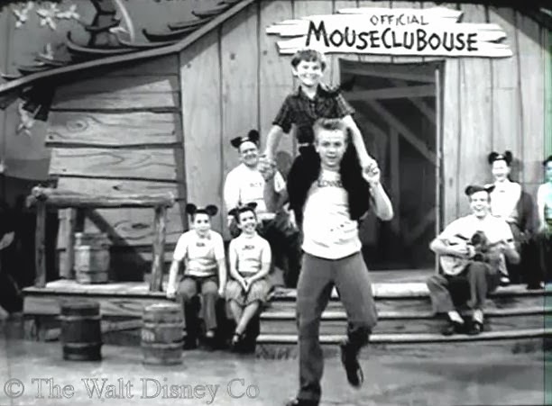
Grade A11 at Grover Cleveland High School a Picture of Kevin Corcoran of Mickey Mouse Club
class with appearance in the 1966 year book the 1967 year book is
censor by The Screen Actors Union
http://www.classmates.com/yearbooks/Grover-Cleveland-High-School/84000?page=146
--
President of The United States
Guy Ralph Perea Sr President of The United States
Weatherdata1046am0426 a Discussion Group of
Weatherdata<http://groups.google.com/group/weatherdata1046am0426>
USFMSC
http://www.cityfreq.com/ca/avalon/>
QUALIFY QICP
OCCUPS
http://www.occupationalinfo.org/02/025062010.html
goldlandabstracts; link check
own search engine - The United
States International Policies
http://lnk.ms/8d5gl aol
http://groups.google.com/group/united-states-of-american
http://twitter.com/ptusss Federal Communication
Commission<http://columbiabroadcast.spaces.live.com/>
Ambassador Chevy Chase; Kevin Corcran; Jack Nickolas; Cher; Shirley Temple
Black; Liza Minnille; Ansari; Ernest Tascoe; Food, Drug and Cosmetic Act
Agent Jodie Foster; Department of Veterans Affairs Director George H.W. Bush
Title 22 USCS section 1928 (b) The e-mail
transmission may contain legally privileged information that
is intended only for the individual or entity recipient, you are hereby,
notified that any disclosure, copying, distribution, or reliance upon the
contents of this E-mail is strictly prohibited. If you have received this
E-mail transmission in error, please reply to the sender, so arrangements
can be made for proper delivery. Title 42
USCS section 192 etseq Margie Paxton Chief of Childrens Bureau
Director of The United States Department of Human Services; Defendant
Article IV General Provisions Section 2
(Supreme Law of The Land) The Constitution of The United States "Any thing
in The Constitution or Laws of any State to the Contrary Notwithstanding"
Contrary to Law (of an act or omission) illegal;
https://twitter.com/presidentus1
UNITED NATIONS DATA from NAS BLYND with COMSECPAC; AOCC; WBUSA SEPTEMBER 24 2013
Gale Report(s)
As reported from a SHIP
(26.70N 90.50W)
Wind speed at 12 UTC 24 Sep 2013 was
41 knots or 21 m/s from 190 degrees or S.
Fog Report(s)
As reported from PORT ARTHUR/JEFFERSON CO., TX.
(29 57N 94 01W 7m)
UNITED STATES OF AMERICA
Fog reported at 12 UTC 24 Sep 2013
(Fog or ice fog in patches)
Visibility: 800m
Fog Report(s)
As reported from LAKE CHARLES/MUN., LA.
(30 07N 93 12W 5m)
UNITED STATES OF AMERICA
Fog reported at 12 UTC 24 Sep 2013
(Fog or ice fog in patches)
Visibility: 400m
Fog Report(s)
As reported from KNOXVILLE/MUN., TN.
(35 49N 83 59W 299m)
UNITED STATES OF AMERICA
Fog reported at 12 UTC 24 Sep 2013
(Fog or ice fog in patches)
Visibility: 800m
As reported from ASHEVILLE/MUN., NC.
(35 26N 82 33W 661m)
UNITED STATES OF AMERICA
Fog reported at 12 UTC 24 Sep 2013
(Fog or ice fog in patches)
Visibility: 400m
Fog Report(s)
As reported from CHARLESTON/KANAWHA., WV.
(38 22N 81 36W 299m)
UNITED STATES OF AMERICA
Fog reported at 12 UTC 24 Sep 2013
(Fog or ice fog in patches)
Visibility: 200m
Thunderstorms Report(s)
As reported from WEST PALM BEACH/ INT. FL.
(26.68N 80.10W 6m)
UNITED STATES OF AMERICA
Thunderstorm as at 18 UTC 24 Sep 2013
(Slight or moderate thunderstorm without hail)
Thunderstorms Report(s)
As reported from MIAMI, FL
(25.75N 80.38W 4m)
UNITED STATES OF AMERICA
Thunderstorm as at 18 UTC 23 Sep 2013
(Slight or moderate thunderstorm without hail)
Thunderstorms Report(s)
As reported from 78328
(23.25N 81.41W )
Thunderstorm as at 18 UTC 23 Sep 2013
(Slight or moderate thunderstorm without hail)
Heavy Rain/Snow Report(s)
As reported from JACKSON/ALLEN C. THOMPSON FIELD, MS.
(32 19N 90 04W 91m)
UNITED STATES OF AMERICA
Heavy Rain/Snow
(Rainfall/Snowfall was 54 mm in the past 24 hours ending at 18 UTC 24 Sep 2013)
HIGH SEAS FORECAST FOR METAREA XII
NWS OCEAN PREDICTION CENTER WASHINGTON DC
1745 UTC TUE SEP 24 2013
CCODE/1:31:12:01:00/AOW+POR/NWS/CCODE
SUPERSEDED BY NEXT ISSUANCE IN 6 HOURS
SEAS GIVEN AS SIGNIFICANT WAVE HEIGHT...WHICH IS THE AVERAGE
HEIGHT OF THE HIGHEST 1/3 OF THE WAVES. INDIVIDUAL WAVES MAY
BE MORE THAN TWICE THE SIGNIFICANT WAVE HEIGHT.
SECURITE
PACIFIC N OF 30N AND S OF 67N E OF A LINE FROM BERING STRAIT
TO 50N 160E
SYNOPSIS VALID 1200 UTC SEP 24.
24 HOUR FORECAST VALID 1200 UTC SEP 25.
48 HOUR FORECAST VALID 1200 UTC SEP 26.
.WARNINGS.
...STORM WARNING...
.LOW 53N177W 971 MB MOVING NE 20 KT. WITHIN 300 NM SE...420 NM
S...300 NM W AND N QUADRANTS WINDS 35 TO 45 KT. SEAS 14 TO 23
FT. ELSEWHERE FROM 40N TO 61N BETWEEN 160W AND 168E WINDS 25 TO
35 KT. SEAS 9 TO 18 FT. ALSO FROM 44N TO 55N BETWEEN 151W AND
160W WINDS 20 TO 30 KT. SEAS TO 9 FT.
.06 HOUR FORECAST LOW 54N174W 968 MB. WITHIN 300 NM S SEMICIRCLE
AND 240 NM NW QUADRANT WINDS 35 TO 50 KT. SEAS 12 TO 24 FT.
.24 HOUR FORECAST LOW 58N165W 976 MB. WITHIN 180 NM NE...360 NM
SE...420 NM SW AND 240 NM NW QUADRANTS WINDS 35 TO 45 KT. SEAS
14 TO 25 FT. ELSEWHERE FROM 44N TO 63N BETWEEN 146W AND 178W
WINDS 25 TO 35 KT. SEAS 10 TO 16 FT.
.48 HOUR FORECAST LOW 58N153W 997 MB. WITHIN 420 NM S AND 360 NM
SE AND SW QUADRANTS WINDS 25 TO 35 KT. SEAS 9 TO 16 FT.
...GALE WARNING...
.LOW 58N141W 1000 MB MOVING SE 20 KT. WITHIN 300 NM SW QUADRANT
WINDS 25 TO 35 KT. SEAS 10 TO 16 FT. ALSO WITHIN 120 NM NE AND
840 NM S QUADRANT WINDS TO 25 KT. SEAS 9 TO 14 FT.
.24 HOUR FORECAST LOW DISSIPATED INLAND. FROM 30N TO 49N BETWEEN
120W AND 131W N TO NW WINDS 20 TO 30 KT. SEAS 9 TO 13 FT.
.48 HOUR FORECAST FROM 30N TO 42N BETWEEN 119W AND 128W N WINDS
25 TO 35 KT. SEAS 9 TO 14 FT.
...GALE WARNING...
.24 HOUR FORECAST NEW LOW NW OF FORECAST AREA 58N166E 996 MB. N
OF 44N W OF 176E WINDS 25 TO 35 KT. SEAS TO 11 FT.
.48 HOUR FORECAST LOW DISSIPATED WITH CONDITIONS ABSORBED INTO
NEW LOW 55N172E MENTIONED BELOW.
...GALE WARNING...
.FROM 30N TO 37N BETWEEN 173E AND 160E NE WINDS 20 TO 30 KT.
SEAS 8 TO 11 FT.
.24 HOUR FORECAST FROM 30N TO 37N BETWEEN 179W AND 160E WINDS 25
TO 35 KT. SEAS 9 TO 13 FT.
.48 HOUR FORECAST FROM 30N TO 38N BETWEEN 175W AND 160E WINDS 20
TO 30 KT. SEAS 8 TO 12 FT.
...GALE WARNING...
.48 HOUR FORECAST LOW 55N172E 984 MB. WITHIN 360 NM SE AND 480
NM S QUADRANTS WINDS 35 TO 45 KT. SEAS 14 TO 21 FT. ELSEWHERE W
OF A LINE FROM 30N160E TO 41N172W TO 47N170W TO 57N170W WINDS 25
TO 40 KT. SEAS 8 TO 16 FT.
.SYNOPSIS AND FORECAST.
.DENSE FOG. VSBY OCCASIONALLY LESS THAN 1 NM FROM 42N TO 54N
BETWEEN 152W AND 169W.
.24 HOUR FORECAST DENSE FOG FROM 42N TO 57N BETWEEN 142W AND
158W.
.48 HOUR FORECAST DENSE FOG WITHIN 180 NM SE OF A LINE FROM
53N136W TO 43N148W AND WITHIN 240 NM E AND S OF A LINE FROM
54N170E TO 43N160E.
.HIGH 40N147W 1028 MB MOVING SE 5 KT.
.24 HOUR FORECAST HIGH 39N145W 1030 MB.
.48 HOUR FORECAST HIGH 39N143W 1027 MB.
.HIGH 41N162E 1026 MB MOVING E 30 KT.
.24 HOUR FORECAST HIGH 42N179E 1031 MB.
.48 HOUR FORECAST HIGH 42N174W 1035 MB.
.HIGH 38N157W 1025 MB NEARLY STATIONARY.
.24 HOUR FORECAST HIGH DISSIPATED.
.48 HOUR FORECAST NEW HIGH 43N137W 1026 MB.
.FORECASTER OSZAJCA. OCEAN PREDICTION CENTER.
NATIONAL HURRICANE CENTER MIAMI FL
E PACIFIC FROM THE EQUATOR TO 30N E OF 140W.
SYNOPSIS VALID 1200 UTC TUE SEP 24.
24 HOUR FORECAST VALID 1200 UTC WED SEP 25.
48 HOUR FORECAST VALID 1200 UTC THU SEP 26.
.WARNINGS.
.NONE.
.SYNOPSIS AND FORECAST.
.NW OF A LINE FROM 30N122W TO 27N140W WINDS 20 KT OR LESS. SEAS
TO 9 FT IN NW SWELL.
.24 HOUR FORECAST N OF 28N BETWEEN 122W AND 128W N WINDS 20 TO
25 KT. SEAS 10 TO 11 FT IN NW SWELL. ELSEWHERE N OF 23N BETWEEN
117W AND 137W WINDS 20 KT OR LESS. SEAS 8 TO 10 FT IN NW SWELL.
.48 HOUR FORECAST N OF A LINE FROM 20N116W TO 20N132W TO 30N138W
WINDS 20 KT OR LESS. SEAS 8 TO 11 FT IN NW SWELL.
.LOW PRES NEAR 13N124W 1007 MB MOVING E 5 KT. FROM 10N TO 13N
BETWEEN 120W AND 125W WINDS 20 KT OR LESS. SEAS 8 FT IN NW SWELL.
.24 HOUR FORECAST LOW PRES NEAR 13N122W 1007 MB. WITHIN 150 NM
SE QUADRANT WINDS 20 KT OR LESS. SEAS 8 FT IN NW SWELL.
.48 HOUR FORECAST LOW PRES NEAR 14N120W 1007 MB. FROM 11N TO 20N
BETWEEN 116W AND 123W WINDS 20 KT OR LESS. SEAS 8 FT IN NW SWELL.
.S OF A LINE FROM 00N111W TO 05N119W TO 05N130W TO 00N135W WINDS
20 KT OR LESS. SEAS 8 FT IN MIXED SE AND NW SWELL.
.24 HOUR FORECAST S OF A LINE FROM 00N110W TO 05N118W TO 05N135W
WINDS 20 KT OR LESS. SEAS 8 TO 9 FT IN MIXED SE AND NW SWELL.
.48 HOUR FORECAST S OF A LINE FROM 00N114W TO 03N126W AND S OF A
LINE FROM 09N126W TO 08N136W TO 00N139W WINDS 20 KT OR LESS.
SEAS 8 FT IN SE SWELL.
.REMAINDER OF AREA WINDS 20 KT OR LESS. SEAS LESS THAN 8 FT.
CONVECTION VALID 1500 UTC TUE SEP 24...
.INTERTROPICAL CONVERGENCE ZONE/MONSOON TROUGH...
THE MONSOON TROUGH IS ALONG 15N93W TO 1009 MB LOW PRES NEAR
15N95W TO 10N104W TO 1007 MB LOW PRES NEAR 15N115W TO 1007 MB
LOW PRES NEAR 13N124W TO 10N127W. THE INTERTROPICAL CONVERGENCE
ZONE AXIS EXTENDS FROM 10N127W TO 10N133W TO 08N140W. SCATTERED
MODERATE FROM 05N TO 08N BETWEEN 76W AND 80W...FROM 12N TO 16N
BETWEEN 93W AND 98W...AND FROM 09N TO 14N BETWEEN 122W AND 127W.
WIDELY SCATTERED MODERATE WITHIN 60 NM EITHER SIDE OF A LINE
FROM 14N98W TO 17N104W...AND FROM 11N TO 13N BETWEEN 118W AND
122W.
.FORECASTER HUFFMAN. NATIONAL HURRICANE CENTER.
NATIONAL WEATHER SERVICE HONOLULU HI
NORTH PACIFIC EQUATOR TO 30N BETWEEN 140W AND 160E
SYNOPSIS VALID 1200 UTC SEP 24 2013.
24 HOUR FORECAST VALID 1200 UTC SEP 25 2013.
48 HOUR FORECAST VALID 1200 UTC SEP 26 2013.
.WARNINGS.
.NONE.
.SYNOPSIS AND FORECAST.
.LOW 27N170E 1010 MB NEARLY STATIONARY. TROUGH FROM LOW TO
23N167E TO 17N160E NEARLY STATIONARY. ANOTHER TROUGH FROM LOW TO
27N165E MOVING SE 10 KT WILL MERGE WITH FIRST TROUGH. ISOLATED
MODERATE TSTMS FROM 19N TO 27N BETWEEN 171E AND 178E.
.24 HOUR FORECAST LOW 28N171E 1009 MB. TROUGH FROM LOW TO
17S160E. WINDS 20 TO 30 KT N OF A LINE FROM 27N160E TO 27N168E
TO 29N173E TO 25N179E.
.48 HOUR FORECAST LOW DISSIPATED. TROUGH FROM 30N162E TO
26N160E. WINDS EASED TO 20 KT OR LESS.
.LOW 26N162E 1011 MB MOVING S 10 KT. TROUGH FROM LOW TO 27N165E
MOVING SE 10 KT.
.24 HOUR FORECAST LOW 22N161E 1010 MB. TROUGH MERGED WITH THE
FEATURE DESCRIBED ABOVE.
.48 HOUR FORECAST LOW W OF AREA.
.TROUGH FROM 10N160E TO 11N166E TO 14N170E MOVING N 10 KT AND
WEAKENING. SCATTERED MODERATE TO STRONG TSTMS WITHIN 90 NM OF
10N165E. ISOLATED MODERATE TSTMS ELSEWHERE S OF 18S W OF 173E.
.24 HOUR FORECAST TROUGH MERGED WITH THE FIRST FEATURE DESCRIBED
ABOVE.
.OTHERWISE WINDS 20 KT OR LESS OVER REMAINDER OF AREA.
.SEAS 8 TO 10 FT NW OF A LINE FROM 30N166E TO 27N160E.
.24 HOUR FORECAST SEAS 8 TO 12 FT N OF A LINE FROM 30N175E TO
27N170E TO 26N160E.
.48 HOUR FORECAST SEAS 8 TO 11 FT N OF A LINE FROM 30N177E TO
24N166E TO 27N160E.
.OTHERWISE SEAS 8 FT OR LESS OVER REMAINDER OF AREA.
.SCATTERED MODERATE TSTMS S OF 08N BETWEEN 173E AND 180E.
ISOLATED MODERATE TSTMS FROM 27N TO 30N BETWEEN 169W AND
172W...AND FROM 21N TO 27N BETWEEN 163W AND 169W.
.ITCZ FROM 08N140W TO 07N154W TO 08N167W TO 06N180W. ISOLATED
MODERATE TSTMS WITHIN 90 NM OF ITCZ W OF 146W.
$$
HIGH SEAS FORECAST FOR METAREA IV
NWS OCEAN PREDICTION CENTER WASHINGTON DC
2230 UTC TUE SEP 24 2013
CCODE/1:31:04:01:00/AOW/NWS/CCODE
SUPERSEDED BY NEXT ISSUANCE IN 6 HOURS
SEAS GIVEN AS SIGNIFICANT WAVE HEIGHT...WHICH IS THE AVERAGE
HEIGHT OF THE HIGHEST 1/3 OF THE WAVES. INDIVIDUAL WAVES MAY
BE MORE THAN TWICE THE SIGNIFICANT WAVE HEIGHT
SECURITE
NORTH ATLANTIC NORTH OF 31N TO 67N AND WEST OF 35W
SYNOPSIS VALID 1800 UTC SEP 24
24 HOUR FORECAST VALID 1800 UTC SEP 25
48 HOUR FORECAST VALID 1800 UTC SEP 26
.WARNINGS.
...GALE WARNING...
.LOW 50N57W 1004 MB NEARLY STATIONARY. WITHIN 240 NM NE OF A
FRONT FROM LOW CENTER TO 43N47W WINDS 25 TO 35 KT. SEAS TO 12
FT. .24 HOUR FORECAST LOW DISSIPATED AND CONDITIONS DESCRIBED
WITH LOW 45N48W BELOW.
...GALE WARNING...
.INLAND LOW 47N64W 1004 MB MOVING SE 10 KT. WITHIN 600 NM S
QUADRANT WINDS TO 25 KT. SEAS LESS THAN 8 FT.
.24 HOUR FORECAST LOW 44N59W 1003 MB. WITHIN 600 NM SW QUADRANT
WINDS TO 25 KT. SEAS LESS THAN 8 FT.
.48 HOUR FORECAST LOW 44N56W 1001 MB. WITHIN 600 NM SW AND 420
NM NW QUADRANTS WINDS 25 TO 35 KT. SEAS 8 TO 14 FT. ELSEWHERE
FROM 36N TO 56N BETWEEN 40W AND 70W WINDS TO 25 KT. SEAS TO 10
FT.
.SYNOPSIS AND FORECAST.
.FROM 54N TO 65N E OF 56W WINDS TO 25 KT. SEAS TO 11 FT.
.24 HOUR FORECAST CONDITIONS DIMINISHED.
.LOW 43N52W 1006 MB MOVING NE 10 KT. WITHIN 600 NM SE QUADRANT
WINDS TO 25 KT. SEAS TO 8 FT.
.24 HOUR FORECAST LOW 45N48W 1004 MB. WITHIN 600 NM NW AND 240
NM NE QUADRANTS WINDS TO 25 KT. SEAS TO 9 FT.
.48 HOUR FORECAST LOW AND CONDITIONS ABSORBED BY LOW 44N56W
DESCRIBED IN WARNINGS SECTION ABOVE.
.LOW E OF AREA 47N24W 988 MB MOVING S 10 KT. OVER FORECAST
WATERS WITHIN 1020 NM SW AND 720 NM NW QUADRANTS WINDS 20 TO 30
KT. SEAS 8 TO 15 FT.
.24 HOUR FORECAST LOW E OF AREA 43N23W 988 MB. OVER FORECAST
WATERS WITHIN 960 NM SW AND 720 NM NW QUADRANTS WINDS 20 TO 30
KT. SEAS TO 11 FT.
.48 HOUR FORECAST LOW AND CONDITIONS WELL E OF AREA.
.DENSE FOG. VSBY LESS THAN 1 NM FROM 42N TO 55N BETWEEN 46W AND
55W AND FROM 52N TO 61N E OF 40W.
.24 HOUR FORECAST DENSE FOG WITHIN 180 NM NE OF A LINE FROM
45N48W TO 54N56W.
.48 HOUR FORECAST DENSE FOG FROM 46N TO 53N BETWEEN 45W AND 53W.
.HIGH 32N38W 1020 MB MOVING SE 20 KT.
.24 HOUR FORECAST HIGH DISSIPATED.
.HIGH 59N60W 1029 MB DRIFTING NE.
.24 HOUR FORECAST HIGH 61N57W 1024 MB.
.48 HOUR FORECAST HIGH 57N58W 1024 MB.
.FORECASTER HOLLEY. OCEAN PREDICTION CENTER.
NATIONAL HURRICANE CENTER MIAMI FL
ATLANTIC FROM 07N TO 31N W OF 35W INCLUDING CARIBBEAN SEA AND
GULF OF MEXICO
SYNOPSIS VALID 1800 UTC TUE SEP 24.
24 HOUR FORECAST VALID 1800 UTC WED SEP 25.
48 HOUR FORECAST VALID 1800 UTC THU SEP 26.
.WARNINGS.
.NONE.
.SYNOPSIS AND FORECAST.
.ATLC 24 HOUR FORECAST LOW PRES NEAR 30N78W. FROM 27N TO 29N
BETWEEN 73W AND 77W SW TO W WINDS 20 TO 25 KT. SEAS TO 8 FT.
.48 HOUR FORECAST LOW PRES NEAR 30N69W. WITHIN 150 SE SEMICIRCLE
S TO SW WINDS 20 TO 25 KT. SEAS TO 8 FT. ELSEWHERE WITHIN 60 NM,
N QUADRANT NE WINDS 20 TO 25 KT. SEAS LESS THAN 8 FT.
.CARIBBEAN FROM 12N TO 15N BETWEEN 68W AND 78W E WINDS 20 TO 25
KT. SEAS TO 9 FT. FROM 15N TO 17N BETWEEN 72W AND 78W E WINDS 20
KT OR LESS. SEAS TO 8 FT IN E SWELL.
.24 HOUR FORECAST FROM 12N TO 15N BETWEEN 72W AND 78W E WINDS 20
TO 25 KT. SEAS TO 8 FT.
.48 HOUR FORECAST WINDS 20 KT OR LESS. SEAS LESS THAN 8 FT.
.REMAINDER OF AREA WINDS 20 KT OR LESS. SEAS LESS THAN 8 FT.
$$
HIGH SEAS FORECAST FOR METAREA XVI
NWS NATIONAL HURRICANE CENTER MIAMI FL
1715 UTC TUE SEP 24 2013
SUPERSEDED BY NEXT ISSUANCE IN 6 HOURS
SEAS GIVEN AS SIGNIFICANT WAVE HEIGHT...WHICH IS THE
AVERAGE HEIGHT OF THE HIGHEST 1/3 OF THE WAVES. INDIVIDUAL
WAVES MAY BE MORE THAN TWICE THE SIGNIFICANT WAVE HEIGHT.
SECURITE
S PACIFIC FROM THE EQUATOR TO 18.5S E OF 120W.
SYNOPSIS VALID 1200 UTC TUE SEP 24.
24 HOUR FORECAST VALID 1200 UTC WED SEP 25.
48 HOUR FORECAST VALID 1200 UTC THU SEP 26.
.WARNINGS.
.NONE.
.SYNOPSIS AND FORECAST.
.S OF 13S W OF 106W E TO SE WINDS 20 TO 25 KT. SEAS 10 TO 12 FT
IN SE SWELL. ELSEWHERE W OF A LINE FROM 00S111W TO 14S82W TO
18.5S82W WINDS 20 KT OR LESS. SEAS 8 TO 11 FT PRIMARILY IN SE
SWELL.
.24 HOUR FORECAST W OF A LINE FROM 00S110W TO 10S99W TO 18.5S99W
WINDS 20 KT OR LESS. SEAS 8 TO 11 FT IN SE SWELL.
.48 HOUR FORECAST W OF A LINE FROM 00S114W TO 18.5S93W WINDS 20
KT OR LESS. SEAS TO 9 FT IN MIXED SE AND SW SWELL.
.REMAINDER OF AREA WINDS 20 KT OR LESS. SEAS LESS THAN 8 FT.
S$
--
President of The United States
Guy Ralph Perea Sr President of The United States
Weatherdata1046am0426 a Discussion Group of
Weatherdata<http://groups.google.com/group/weatherdata1046am0426>
USFMSC
http://www.cityfreq.com/ca/avalon/>
QUALIFY QICP
OCCUPS
http://www.occupationalinfo.org/02/025062010.html
goldlandabstracts; link check
own search engine - The United
States International Policies
http://lnk.ms/8d5gl aol
http://groups.google.com/group/united-states-of-american
http://twitter.com/ptusss Federal Communication
Commission<http://columbiabroadcast.spaces.live.com/>
Ambassador Chevy Chase; Kevin Corcran; Jack Nickolas; Cher; Shirley Temple
Black; Liza Minnille; Ansari; Ernest Tascoe; Food, Drug and Cosmetic Act
Agent Jodie Foster; Department of Veterans Affairs Director George H.W. Bush
Title 22 USCS section 1928 (b) The e-mail
transmission may contain legally privileged information that
is intended only for the individual or entity recipient, you are hereby,
notified that any disclosure, copying, distribution, or reliance upon the
contents of this E-mail is strictly prohibited. If you have received this
E-mail transmission in error, please reply to the sender, so arrangements
can be made for proper delivery. Title 42
USCS section 192 etseq Margie Paxton Chief of Childrens Bureau
Director of The United States Department of Human Services; Defendant
Article IV General Provisions Section 2
(Supreme Law of The Land) The Constitution of The United States "Any thing
in The Constitution or Laws of any State to the Contrary Notwithstanding"
Contrary to Law (of an act or omission) illegal;
https://twitter.com/ptusss
FLIGHT DELAYS and RADIO REPORT from NAS BLYND with FORTUNA/FAA SEPTEMBER 24 2013
Flight Delay Information - Air Traffic Control System Command Center
ATCSCC Home | Products | What's New | Site Map | ATCSCC FAQ |
Diversion Forums | Text-Only Version
View by Region:
View by Region
Search by Airport:
Search by Airport
(Enter city, airport code, airport name) View by Major Airport:
View by Major Airport
Portland International Airport (PDX)
Portland, Oregon
General Arrival/Departure delays are 15 minutes or less.
Seattle-Tacoma International Airport (SEA)
Seattle, Washington
General Arrival/Departure delays are 15 minutes or less.
San Francisco International (SFO)
San Francisco, California
General Departure Delays: Due to WX:Wind, traffic is experiencing Gate
Hold and Taxi delays between 31 minutes and 45 minutes in length and
increasing. Click for more info.
San Jose International Airport (SJC)
San Jose, California
General Arrival/Departure delays are 15 minutes or less.
Los Angeles International Airport (LAX)
Los Angeles, California
General Arrival/Departure delays are 15 minutes or less.
San Diego-Lindbergh Field Airport (SAN)
San Diego, California
General Arrival/Departure delays are 15 minutes or less.
Las Vegas McCarran International (LAS)
Las Vegas, Nevada
General Arrival/Departure delays are 15 minutes or less.
Phoenix Sky Harbor International Airport (PHX)
Phoenix, Arizona
General Arrival/Departure delays are 15 minutes or less.
Salt Lake City International Airport (SLC)
Salt Lake City, Utah
General Arrival/Departure delays are 15 minutes or less.
Denver International Airport (DEN)
Denver, Colorado
General Arrival/Departure delays are 15 minutes or less.
Kansas City International Airport (MCI)
Kansas City, Missouri
General Arrival/Departure delays are 15 minutes or less.
Dallas/Ft Worth International Airport (DFW)
Dallas-Ft Worth, Texas
General Arrival/Departure delays are 15 minutes or less.
George Bush Intercontinental/Houston Airport (IAH)
Houston, Texas
General Arrival/Departure delays are 15 minutes or less.
Minneapolis-St Paul International/Wold-Chamberlain Airport (MSP)
Minneapolis, Minnesota
General Arrival/Departure delays are 15 minutes or less.
Lambert-St Louis International Airport (STL)
St Louis, Missouri
General Arrival/Departure delays are 15 minutes or less.
Memphis International Airport (MEM)
Memphis, Tennessee
General Arrival/Departure delays are 15 minutes or less.
Chicago OHare International Airport (ORD)
Chicago, Illinois
General Arrival/Departure delays are 15 minutes or less.
Chicago Midway Airport (MDW)
Chicago, Illinois
General Arrival/Departure delays are 15 minutes or less.
Indianapolis International Airport (IND)
Indianapolis, Indiana
General Arrival/Departure delays are 15 minutes or less.
Nashville International Airport (BNA)
Nashville, Tennessee
General Arrival/Departure delays are 15 minutes or less.
Cincinnati/Northern Kentucky International Airport (CVG)
Covington/Cincinnati, OH, Kentucky
General Arrival/Departure delays are 15 minutes or less.
Detroit Metropolitan Wayne County Airport (DTW)
Detroit, Michigan
General Arrival/Departure delays are 15 minutes or less.
The William B Hartsfield International Airport (ATL)
Atlanta, Georgia
General Arrival/Departure delays are 15 minutes or less.
Cleveland Hopkins International Airport (CLE)
Cleveland, Ohio
General Arrival/Departure delays are 15 minutes or less.
Pittsburgh International Airport (PIT)
Pittsburgh, Pennsylvania
General Arrival/Departure delays are 15 minutes or less.
Tampa International Airport (TPA)
Tampa, Florida
General Arrival/Departure delays are 15 minutes or less.
Charlotte Douglas International Airport (CLT)
Charlotte, North Carolina
General Arrival/Departure delays are 15 minutes or less.
Orlando International (MCO)
Orlando, Florida
General Arrival/Departure delays are 15 minutes or less.
Washington Dulles International (IAD)
Washington, District of Columbia
General Arrival/Departure delays are 15 minutes or less.
Raleigh-Durham International Airport (RDU)
Raleigh/Durham, North Carolina
General Arrival/Departure delays are 15 minutes or less.
Fort Lauderdale/Hollywood International Airport (FLL)
Fort Lauderdale, Florida
General Arrival/Departure delays are 15 minutes or less.
Miami International Airport (MIA)
Miami, Florida
General Arrival/Departure delays are 15 minutes or less.
Ronald Reagan Washington National Airport (DCA)
Washington, District of Columbia
General Arrival/Departure delays are 15 minutes or less.
Baltimore-Washington International Airport (BWI)
Baltimore, Maryland
General Arrival/Departure delays are 15 minutes or less.
Philadelphia International Airport (PHL)
Philadelphia, Pennsylvania
General Arrival/Departure delays are 15 minutes or less.
Teterboro (TEB)
Teterboro, New Jersey
General Arrival/Departure delays are 15 minutes or less.
Newark International Airport (EWR)
Newark, New Jersey
General Arrival/Departure delays are 15 minutes or less.
La Guardia (LGA)
New York, New York
General Arrival/Departure delays are 15 minutes or less.
John F Kennedy International (JFK)
New York, New York
General Arrival/Departure delays are 15 minutes or less.
General Edward Lawrence Logan International Airport (BOS)
Boston, Massachusetts
General Arrival/Departure delays are 15 minutes or less.
The status information provided on this site indicates general airport
conditions; it is not flight-specific. Check with your airline to
determine if your flight is affected.Information on wait times at
security checkpoints.
Legend
General Arrival/Departure delays are 15 minutes or less.
Departures are experiencing taxi delays of 16 to 45 minutes and/or
arrivals are experiencing airborne holding delays of 16 to 45 minutes.
Traffic destined to this airport is being delayed at its departure
point. Check your departure airport to see if your flight may be
affected.
Departures are experiencing taxi delays greater than 45 minutes and/or
arrivals are experiencing airborne holding delays greater than 45
minutes.
This denotes a closed airport!
09-24-13 07:31 Wx data collected by AF6EX, TUOLUMNE, CA
--------------------------------------------------------------------------------
CALL LOCATION ELEV HI LO CU BARO-+ WIND/PK VIS SKY
PRCP HUM/DP REM
--------------------------------------------------------------------------------
Alameda County
WA6CUY, Oakland 350 83 52 55 3000-01 SE2/12 UL CLR
0.01 NA PKG1545
Alpine County
KA6EGX, WOODFORD 5800 75 54 60 3092-03 CLM UL CLR
0.00 23/23
Amador County
K6KBE, Ione 670 80 56 61 2988-04 W2/N16 UL SCT
0.00 87/57 PKG1500
KG6MH, Pioner 3100 73 53 57 2992-NC CLM UL CLR
0.00 64/47
Humboldt County
K6PIJ, FORTUNA 208 79 57 57 3002-NC NW4/SW18 8 FAIR
0.01 96/56 PKG0214
Lake County
W6WMV, FINLEY 1350 80 52 57 3002-06 CLM/6 UL SCT
0.00 89/49 PKG1705
Mendocino County
WA6QPG, Covolo 1410 81 50 50 2962-05 CLM UL SCT 0.00 NA
San Bernardino County
WA6OQQ, Lake Arrow Head 5500 73 51 59 3003+18 CLM UL CLR
0.00 23/23
Sierra County
K1NV, LOYTON 5150 76 41 54 2994-09 NW6/NW13 UL SCT
0.00 43/32 PKG1643
Siskiyou County
KG6AFA, Mt Shasta 3800 67 47 48 2979-10 CLM/SE16 UL OVC
0.00 84/43 PKG1336
W6NPS, FRENCH CREEK 3200 69 48 48 2977-01 CLM 8 OVC
0.00 87/44
Tuolumne County
AF6EX, TUOLUMNE 2800 77 50 57 2988-06 CLM/NW9 UL CLR
0.02 70/47 PKG1318
Out Of State
W7VOS, Kalispell 3000 61 44 46 2993+09 CLM/SW14 UL OVC
TR 82/41 PKG1601
WA7HVA, GALEANA 5050 80 47 56 2986-14 SW5/SW17 UL CLR 0.00 NA
K7SEG, Gold Beach 50 66 56 56 2997+05 CLM/SW16 UL OVC
0.10 96/55 PKG0650
WA7EXI, Hood River 750 60 51 52 2991+03 SE1/W9 UL SCT
0.04 88/52 PKG0013
WL7SD, DIMOND PT AP 250 63 52 52 2986+15 N2/N7 UL FAIR
0.1 97/50 PKG2301
KF4LJX, VANCOUVER WA 216 61 51 51 2997+03 CLM/S14 UL OVC
0.15 99/52 PKG0201
K7VVF, PORTLAND 6508 61 51 51 2991-03 CLM/8 UL OVC
0.71 98/53 PKG1030
S$
--
President of The United States
Guy Ralph Perea Sr President of The United States
Weatherdata1046am0426 a Discussion Group of
Weatherdata<http://groups.google.com/group/weatherdata1046am0426>
USFMSC
http://www.cityfreq.com/ca/avalon/>
QUALIFY QICP
OCCUPS
http://www.occupationalinfo.org/02/025062010.html
goldlandabstracts; link check
own search engine - The United
States International Policies
http://lnk.ms/8d5gl aol
http://groups.google.com/group/united-states-of-american
http://twitter.com/ptusss Federal Communication
Commission<http://columbiabroadcast.spaces.live.com/>
Ambassador Chevy Chase; Kevin Corcran; Jack Nickolas; Cher; Shirley Temple
Black; Liza Minnille; Ansari; Ernest Tascoe; Food, Drug and Cosmetic Act
Agent Jodie Foster; Department of Veterans Affairs Director George H.W. Bush
Title 22 USCS section 1928 (b) The e-mail
transmission may contain legally privileged information that
is intended only for the individual or entity recipient, you are hereby,
notified that any disclosure, copying, distribution, or reliance upon the
contents of this E-mail is strictly prohibited. If you have received this
E-mail transmission in error, please reply to the sender, so arrangements
can be made for proper delivery. Title 42
USCS section 192 etseq Margie Paxton Chief of Childrens Bureau
Director of The United States Department of Human Services; Defendant
Article IV General Provisions Section 2
(Supreme Law of The Land) The Constitution of The United States "Any thing
in The Constitution or Laws of any State to the Contrary Notwithstanding"
Contrary to Law (of an act or omission) illegal;
https://twitter.com/ptusss
AT UN DEBATE, BRAZILIAN PRESIDENT URGES PROTECTION OF INTERNET USERS
From: UNNews <UNNews@un.org>
Date: 24 Sep 2013 12:00:01 -0400
Subject: AT UN DEBATE, BRAZILIAN PRESIDENT URGES PROTECTION OF INTERNET USERS
To: news11@ny-mail-p-lb-028.ptc.un.org
AT UN DEBATE, BRAZILIAN PRESIDENT URGES PROTECTION OF INTERNET
USERSNew York, Sep 24 2013 12:00PMIn her speech to the General
Assembly's high-level debate today, the President of Brazil, Dilma
Roussef, urged the United Nations to play a leading role in protecting
Internet users from illegal interception of communications and data,
and decried recent allegations of electronic information spying as
"serious violations of human rights".
Meddling in such a manner in the lives and affairs of other countries
is a breach of international law and as such it is an affront to the
principles that should otherwise govern relations among countries,
especially among friendly nations," Ms. Roussef said in reference to
allegations that the information had been illegally gathered on the
activities of the Brazilian Government.
Addressing a chamber of world leaders, as well as Secretary-General
Ban Ki-moon and John Ashe, President of the 68th General Assembly, Ms.
Roussef urged "the United Nations must properly regulate the behaviour
of Member States regarding these technologies."
She said Brazil would present proposals for the establishment of a
framework for the governance and use of the Internet, and to ensure
the effective protection of data that travels through the web.
It will be based on five key principles: freedom of speech; open,
multi-lateral governance with transparency; principle of universality
and non-discrimination; cultural diversity without imposing values;
and network neutrality, guided only by technical and ethical criteria.
In her statement, Ms. Roussef noted Brazil's fight "against poverty,
hunger and inequality" which constitutes "the greatest challenge of
our time."
The UN is currently amidst its 800 days of accelerated action towards
progress on the eight anti-poverty targets known as the Millennium
Development Goals (MDGs), and laying the foundation for a sustainable
development agenda in the years following the deadline in 2015.
"In the debate on the post-2015 Development Agenda we must focus on
the result of the Rio+20," Ms. Roussef said referring to the 2012 UN
Conference on Sustainable Development.
Rio+20's outcome document "The Future We Want" led to the creation of
the High-level Political Forum which aims to ensure that sustainable
development tops the agenda of the highest levels of Government and is
embraced by all actors. The Forum is due to meet for the first time
today on the sidelines of the General Assembly.
Noting the June protests in parts of Brazil, Ms. Roussef said her
Government listened to the demonstrators as an "inseparable part of
the development of our democracy and of social change."
Turning to Security Council reform, Ms. Roussef said the body's
"limited representation" is an issue of "grave concern" exemplified
by its immense difficulty in offering a solution to the Syrian
conflict and paralysis in addressing the Israeli-Palestinian conflict.
"We must provide the Council with voices that are at once independent
and constructive," the President said, urging expansion of the number
of permanent and non-permanent members "to solve and overcome the
Council's definite of representation and legitimacy."
On the issue of Syria, Ms. Roussef said it is "necessary to stop the
killing" and cease the use of conventional and chemical arms, whether
by the Government or the rebels.
She underscored that there is no military outcome to the crisis and
that "the only solution is through negotiation, dialogue and
understanding."
Similarly, it is now time, Ms. Roussef said, to realize the wide
international consensus in favour to the two-state solution between
Israelis and Palestinians.
Ms. Roussef and Mr. Ban discussed these topics during a bilateral
meeting earlier today. According to a UN spokesperson, Mr. Ban also
thanked Brazil for its "unwavering support" for Haiti and
"outstanding" work of the Brazilian troops deployed to the UN
Stabilization Mission in Haiti known as MINUSTAH. Sep 24 2013 12:00PM
________________
For more details go to UN News Centre at http://www.un.org/news
Follow us on Facebook (http://www.facebook.com/UN.News.Centre) and
Twitter (http://twitter.com/UN_News_Centre)
To change your profile or unsubscribe go to: http://www.un.org/apps/news/email/
--
President of The United States
Guy Ralph Perea Sr President of The United States
Weatherdata1046am0426 a Discussion Group of
Weatherdata<http://groups.google.com/group/weatherdata1046am0426>
USFMSC
http://www.cityfreq.com/ca/avalon/>
QUALIFY QICP
OCCUPS
http://www.occupationalinfo.org/02/025062010.html
goldlandabstracts; link check
own search engine - The United
States International Policies
http://lnk.ms/8d5gl aol
http://groups.google.com/group/united-states-of-american
http://twitter.com/ptusss Federal Communication
Commission<http://columbiabroadcast.spaces.live.com/>
Ambassador Chevy Chase; Kevin Corcran; Jack Nickolas; Cher; Shirley Temple
Black; Liza Minnille; Ansari; Ernest Tascoe; Food, Drug and Cosmetic Act
Agent Jodie Foster; Department of Veterans Affairs Director George H.W. Bush
Title 22 USCS section 1928 (b) The e-mail
transmission may contain legally privileged information that
is intended only for the individual or entity recipient, you are hereby,
notified that any disclosure, copying, distribution, or reliance upon the
contents of this E-mail is strictly prohibited. If you have received this
E-mail transmission in error, please reply to the sender, so arrangements
can be made for proper delivery. Title 42
USCS section 192 etseq Margie Paxton Chief of Childrens Bureau
Director of The United States Department of Human Services; Defendant
Article IV General Provisions Section 2
(Supreme Law of The Land) The Constitution of The United States "Any thing
in The Constitution or Laws of any State to the Contrary Notwithstanding"
Contrary to Law (of an act or omission) illegal;
https://twitter.com/ptusss
Monday, September 23, 2013
UNITED NATIONS DATA from NAS BLYND with COMSECPAC; AOCC; WBUSA September 23 2013
Fog Report(s)
As reported from CHARLESTON/KANAWHA., WV.
(38 22N 81 36W 299m)
UNITED STATES OF AMERICA
Fog reported at 06 UTC 23 Sep 2013
(Fog or ice fog in patches)
Visibility: 800m
Thunderstorms Report(s)
As reported from ALBUQUERQUE/INT., NM.
(35.03N 106.61W 1618m)
UNITED STATES OF AMERICA
Thunderstorm as at 00 UTC 23 Sep 2013
(Slight or moderate thunderstorm without hail)
Thunderstorms Report(s)
As reported from a SHIP
(26.60N 91.00W )
Thunderstorm as at 12 UTC 23 Sep 2013
(Slight or moderate thunderstorm without hail)
Thunderstorms Report(s)
As reported from MIAMI, FL
(25.75N 80.38W 4m)
UNITED STATES OF AMERICA
Thunderstorm as at 18 UTC 23 Sep 2013
(Slight or moderate thunderstorm without hail)
Heavy Rain/Snow Report(s)
As reported from APALACHICOLA/MUN., FL.
(29 44N 85 02W 6m)
UNITED STATES OF AMERICA
Heavy Rain/Snow
(Rainfall/Snowfall was 61 mm in the past 24 hours ending at 00 UTC 23 Sep 2013)
HIGH SEAS FORECAST FOR METAREA XII
NWS OCEAN PREDICTION CENTER WASHINGTON DC
1745 UTC MON SEP 23 2013
CCODE/1:31:12:01:00/AOW+POR/NWS/CCODE
SUPERSEDED BY NEXT ISSUANCE IN 6 HOURS
SEAS GIVEN AS SIGNIFICANT WAVE HEIGHT...WHICH IS THE AVERAGE
HEIGHT OF THE HIGHEST 1/3 OF THE WAVES. INDIVIDUAL WAVES MAY
BE MORE THAN TWICE THE SIGNIFICANT WAVE HEIGHT.
SECURITE
PACIFIC N OF 30N AND S OF 67N E OF A LINE FROM BERING STRAIT
TO 50N 160E
SYNOPSIS VALID 1200 UTC SEP 23.
24 HOUR FORECAST VALID 1200 UTC SEP 24.
48 HOUR FORECAST VALID 1200 UTC SEP 25.
.WARNINGS.
...STORM WARNING...
.LOW 57N141W 975 MB MOVING SE 05 KT. WITHIN 480 NM SW SEMICIRCLE
WINDS 35 TO 50 KT. SEAS 16 TO 27 FT. ELSEWHERE FROM 45N TO 60N
BETWEEN 129W AND 157W WINDS 25 TO 35 KT. SEAS 12 TO 18 FT.
.24 HOUR FORECAST LOW 56N139W 1002 MB. WITHIN 660 NM S AND 180
NM W QUADRANTS WINDS 25 TO 40 KT. SEAS 12 TO 18 FT.
.48 HOUR FORECAST LOW DISSIPATED INLAND. FROM 30N TO 49N BETWEEN
120W AND 133W N TO NW WINDS 20 TO 30 KT. SEAS 9 TO 15 FT.
...STORM WARNING...
.LOW 48N174E 999 MB MOVING NE 20 KT. BETWEEN 240 NM AND 720 NM
SW QUADRANTS WINDS 25 TO 35 KT. SEAS TO 11 FT.
.24 HOUR FORECAST LOW 54N175W 971 MB. WITHIN 240 NM NE...360 NM
SE...540 NM SW...AND 300 NM NW QUADRANTS WINDS 30 TO 45 KT. SEAS
10 TO 20 FT. ALSO FROM 40N TO 56N BETWEEN 154W AND 167E WINDS 25
TO 35 KT. SEAS 8 TO 12 FT.
.30 HOUR FORECAST LOW 55N174W 966 MB. WITHIN 300 NM OF LOW
CENTER EXCEPT E QUADRANT WINDS 35 TO 50 KT. SEAS 12 TO 23 FT.
.48 HOUR FORECAST LOW 58N165W 973 MB. WITHIN 420 NM SE AND 360
NM SW QUADRANTS WINDS 35 TO 50 KT. SEAS 15 TO 24 FT. ELSEWHERE
FROM N OF 46N AND BETWEEN 145W AND 180W WINDS 25 TO 35 KT. SEAS
9 TO 15 FT.
...STORM WARNING...
.LOW NW OF AREA 55N169E 992 MB MOVING SE 20 KT. OVER FORECAST
WATERS WITHIN 240 NM S QUADRANT AND WITHIN 120 NM N AND NE OF A
FRONT FROM 58N178E TO 58N174W TO 55N171W WINDS 25 TO 35 KT. SEAS
8 TO 12 FT.
.06 HOUR FORECAST LOW 53N170E 991 MB. WITHIN 180 NM S AND SW
QUADRANT WINDS 35 TO 50 KT. SEAS 12 TO 23 FT.
.24 HOUR FORECAST LOW AND CONDITIONS TO MERGE WITH LOW 54N175W
MENTIONED ABOVE.
...GALE WARNING...
.48 HOUR FORECAST N OF 46N AND W OF 176E WINDS 25 TO 35 KT. SEAS
8 TO 14 FT.
.SYNOPSIS AND FORECAST.
.LOW 47N178W 1007 MB MOVING N 10 KT. A FRONT EXTENDS FROM LOW SW
TO 42N175E. WITHIN 420 NM E OF THE FRONT WINDS 20 TO 30 KT. SEAS
TO 11 FT.
.24 HOUR FORECAST LOW AND CONDITIONS TO MERGE WITH LOW 54N175W
MENTIONED IN WARNINGS SECTION.
.FROM 30N TO 37N W OF 164E NE WINDS TO 25 KT. SEAS TO 10 FT.
.24 HOUR FORECAST FROM 30N TO 36N W OF 175E E TO NE WINDS 20 TO
30 KT. SEAS 8 TO 11 FT.
.48 HOUR FORECAST FROM 30N TO 38N E OF 179W. E WINDS 20 TO 30
KT. SEAS 8 TO 12 FT.
.FROM 30N TO 36N BETWEEN 120W AND 125W NW WINDS 20 TO 30 KT.
SEAS TO 10 FT.
.24 HOUR FORECAST FROM 30N TO 36N BETWEEN 121W AND 125W N WINDS
TO 25 KT. SEAS TO 9 FT.
.48 HOUR FORECAST CONDITIONS TO MERGE WITH CONDITIONS IN WARNING
SECTION.
.DENSE FOG. VSBY OCCASIONALLY LESS THAN 1 NM FROM 41N TO 47N
BETWEEN 161W AND 176E AND FROM 47N TO 52N BETWEEN 172W AND 179E.
.24 HOUR FORECAST DENSE FOG FROM 42N TO 55N BETWEEN 153W AND
170W.
.48 HOUR FORECAST DENSE FOG FROM 42N TO 58N BETWEEN 145W AND
157W...AND N OF A LINE FROM 45N160E TI 51N172E.
.HIGH 40N154W 1025 MB MOVING E 15 KT.
.24 HOUR FORECAST HIGH 40N148W 1028 MB.
.48 HOUR FORECAST HIGH 39N148W 1030 MB.
.HIGH 36N164W 1025 MB MOVING NE 10 KT.
.24 HOUR FORECAST HIGH 39N157W 1025 MB.
.48 HOUR FORECAST HIGH TO MERGE WITH HIGH 39N148W MENTIONED
ABOVE.
.24 HOUR FORECAST HIGH 41N162E 1026 MB.
.48 HOUR FORECAST HIGH 42N178E 1031 MB.
.FORECASTER OSZAJCA. OCEAN PREDICTION CENTER.
NATIONAL HURRICANE CENTER MIAMI FL
E PACIFIC FROM THE EQUATOR TO 30N E OF 140W.
SYNOPSIS VALID 1200 UTC MON SEP 23.
24 HOUR FORECAST VALID 1200 UTC TUE SEP 24.
48 HOUR FORECAST VALID 1200 UTC WED SEP 25.
.WARNINGS.
.NONE.
.SYNOPSIS AND FORECAST.
.N OF 28N E OF 123W WINDS 20 KT OR LESS. SEAS TO 9 FT IN NW
SWELL.
.24 HOUR FORECAST N OF 28N W OF 130W WINDS 20 KT OR LESS. SEAS
TO 9 FT IN NW SWELL.
.48 HOUR FORECAST W OF LINE 30N117W TO 24N123W WINDS 20 KT OR
LESS. SEAS 8 TO 11 FT NW SWELL.
.FROM 08N TO 10N BETWEEN 113W AND 116W WINDS 20 KT OR LESS. SEAS
TO 8 FT IN SW SWELL.
.24 HOUR FORECAST WINDS 20 KT OR LESS. SEAS LESS THAN 8 FT.
.12 HOUR FORECAST S OF 03N BETWEEN 114W AND 119W WINDS 20 KT OR
LESS. SEAS TO 8 FT IN SE SWELL.
.24 HOUR FORECAST S OF 04N BETWEEN 115W AND 130W WINDS 20 KT OR
LESS. SEAS 8 FT IN IN SE SWELL.
.48 HOUR FORECAST S OF 05N BETWEEN 115W AND 133W WINDS 20 KT OR
LESS. SEAS 9 FT IN MERGING SE AND NW SWELL.
.REMAINDER OF AREA WINDS 20 KT OR LESS. SEAS LESS THAN 8 FT.
CONVECTION VALID 1500 UTC MON SEP 23...
.INTERTROPICAL CONVERGENCE ZONE/MONSOON TROUGH...
.SCATTERED MODERATE TO STRONG FROM 10N TO 15N BETWEEN 90W AND
100W.
MONSOON TROUGH FROM 15N93W TO 1006 MB LOW NEAR 15N103W TO
08N140W. SCATTERED MODERATE TO STRONG WITHIN 40 NM EITHER SIDE
OF AXIS FROM 113W TO 116W AND WITHIN 50 NM N AND 90 NM S OF AXIS
FROM 122W TO 126W.
.FORECASTER DGS. NATIONAL HURRICANE CENTER.
NATIONAL WEATHER SERVICE HONOLULU HI
NORTH PACIFIC EQUATOR TO 30N BETWEEN 140W AND 160E
SYNOPSIS VALID 1200 UTC SEP 23 2013.
24 HOUR FORECAST VALID 1200 UTC SEP 24 2013.
48 HOUR FORECAST VALID 1200 UTC SEP 25 2013.
.WARNINGS.
.NONE.
.SYNOPSIS AND FORECAST.
.LOW 27N164E 1008 MB MOVING E 10 KT. TROUGH FROM LOW TO 23N165E
TO ANOTHER LOW AT 18N162E 1007 MB.
.24 HOUR FORECAST LOW 28N172E 1010 MB. NE WINDS 20 TO 25 KT N OF
A LINE...28N160E TO 30N165E.
.48 HOUR FORECAST LOW 28N174E 1008 MB. WINDS 20 TO 25 KT WITHIN
250 NM N AND NW QUADRANTS OF LOW.
.LOW 19N163E 1010 MB MOVING E SLOWLY.
.24 HOUR FORECAST LOW DISSIPATED.
.TROUGH FROM 17N163W TO 12N166W MOVING W 10 KT.
.24 HOUR FORECAST TROUGH DISSIPATED.
.RIDGE FROM 22N1780E TO 08N163E NEARLY STATIONARY.
.OTHERWISE WINDS 20 KT OR LESS OVER REMAINDER OF AREA.
.SEAS 8 TO 9 FT NW OF A LINE 30N162E TO 28N160E.
.24 HOUR FORECAST SEAS 8 TO 9 FT N OF A LINE...30N165E TO
27N160E.
.48 HOUR FORECAST SEAS 8 TO 12FT N OF 27N W OF 177E.
.OTHERWISE SEAS 8 FT OR LESS OVER REMAINDER OF AREA.
.ISOLATED MODERATE TSTMS BETWEEN 10N AND 05N FROM 177E TO 165E.
$$
HIGH SEAS FORECAST FOR METAREA IV
NWS OCEAN PREDICTION CENTER WASHINGTON DC
1630 UTC MON SEP 23 2013
CCODE/1:31:04:01:00/AOW/NWS/CCODE
SUPERSEDED BY NEXT ISSUANCE IN 6 HOURS
SEAS GIVEN AS SIGNIFICANT WAVE HEIGHT...WHICH IS THE AVERAGE
HEIGHT OF THE HIGHEST 1/3 OF THE WAVES. INDIVIDUAL WAVES MAY
BE MORE THAN TWICE THE SIGNIFICANT WAVE HEIGHT
SECURITE
NORTH ATLANTIC NORTH OF 31N TO 67N AND WEST OF 35W
SYNOPSIS VALID 1200 UTC SEP 23
24 HOUR FORECAST VALID 1200 UTC SEP 24
48 HOUR FORECAST VALID 1200 UTC SEP 25
.WARNINGS.
...STORM WARNING...
.LOW 62N58W 1000 MB MOVING NE 15 KT. FRONT EXTENDS FROM 62N55W
TO 60N51W. WITHIN 120 NM E OF FRONT WINDS 35 TO 50 KT. SEAS 13
TO 20 FT. ELSEWHERE WITHIN 180 NM W QUADRANT WINDS 25 TO 35 KT.
SEAS 9 TO 14 FT.
.24 HOUR FORECAST LOW N OF AREA AND ASSOCIATED CONDITIONS
DIMINISHED.
...GALE WARNING...
.LOW E OF AREA 50N30W 992 MB MOVING SE 15 KT. OVER FORECAST
WATERS WITHIN 480 NM W AND S QUADRANTS WINDS 25 TO 40 KT. SEAS
18 TO 26 FT. ELSEWHERE WITHIN 720 NM N QUADRANT WINDS 25 TO 35
KT. SEAS 9 TO 16 FT.
.24 HOUR FORECAST LOW WELL E OF AREA. FROM 38N TO 52N E OF 38W
AREA OF N WINDS 20 TO 30 KT. SEAS 10 TO 16 FT.
.48 HOUR FORECAST CONDITIONS E OF AREA.
...GALE WARNING...
.LOW 47N63W 1000 MB MOVING NE 10 KT. OVER FORECAST WATERS WITHIN
420 NM SE QUADRANT WINDS TO 25 KT. SEAS 9 TO 11 FT.
.24 HOUR FORECAST LOW 50N56W 1002 MB. WITHIN 120 NM NE OF A
FRONT TO EXTEND FROM LOW TO 43N50W WINDS 25 TO 35 KT. SEAS 10 TO
14 FT. .48 HOUR FORECAST LOW 46N62W 1005 MB. BETWEEN 480 NM AND
660 NM NE QUADRANT WINDS TO 25 KT. SEAS 8 TO 11 FT.
.SYNOPSIS AND FORECAST.
.LOW 38N57W 1006 MB MOVING NE 15 KT. OVER FORECAST WATERS WITHIN
420 NM E QUADRANT WINDS 20 TO 30 KT. SEAS TO 12 FT.
.24 HOUR FORECAST LOW 43N56W 1003 MB. WITHIN 300 NM SE QUADRANT
WINDS TO 25 KT. SEAS 10 FT.
.30 HOUR FORECAST LOW AND CONDITIONS ABSORBED BY LOW 50N56W
DESCRIBED IN WARNINGS SECTION ABOVE.
.LOW 35N73W 1006 MB MOVING E 15 KT. OVER FORECAST WATERS WITHIN
120 NM NW SEMICIRCLE AND 180 NM SE QUADRANT WINDS TO 25 KT. SEAS
TO 9 FT.
.24 HOUR FORECAST LOW 37N64W 1008 MB. WITHIN 300 NM NW QUADRANT
WINDS TO 25 KT. SEAS TO 9 FT.
.DENSE FOG. VSBY LESS THAN 1 NM OVER FORECAST WATERS FROM 49N TO
60N BETWEEN 49W AND 60W AND FROM 44N TO 48N BETWEEN 57W AND 64W.
.24 HOUR FORECAST DENSE FOG FROM 42N TO 57N BETWEEN 47W AND 55W.
.48 HOUR FORECAST DENSE FOG WITHIN 180 NM SW OF A LINE FROM
56N53W TO 46N46W.
.HIGH 38N41W 1026 MB MOVING SE 15 KT.
.24 HOUR FORECAST HIGH 31N36W 1021 MB.
.48 HOUR FORECAST HIGH S OF AREA.
.48 HOUR FORECAST HIGH 59N62W 1025 MB.
.FORECASTER MCRANDAL. OCEAN PREDICTION CENTER.
NATIONAL HURRICANE CENTER MIAMI FL
ATLANTIC FROM 07N TO 31N W OF 35W INCLUDING CARIBBEAN SEA AND
GULF OF MEXICO
SYNOPSIS VALID 1200 UTC MON SEP 23.
24 HOUR FORECAST VALID 1200 UTC TUE SEP 24.
48 HOUR FORECAST VALID 1200 UTC WED SEP 25.
.WARNINGS.
SOME ISOLATED SQUALLS NORTH OF 28 DEGREES NORTH EAST 95 WEST TO FLORIDA COAST
.SYNOPSIS AND FORECAST.
.ATLC N OF 29N E OF 47W WINDS 20 KT OR LESS. SEAS TO 8 FT IN N
SWELL.
.24 HOUR FORECAST N OF 26N E OF 40W WINDS 20 KT OR LESS. SEAS TO
8 FT IN N SWELL.
.48 HOUR FORECAST WINDS 20 KT OR LESS. SEAS LESS THAN 8 FT.
.ATLC 48 HOUR FORECAST DEVELOPING LOW PRES NEAR 30N77W 1008 MB.
OVER FORECAST WATERS WITHIN 120 NM SE SEMICIRCLE WINDS 20 TO 25
KT. SEAS TO 8 FT.
.CARIBBEAN FROM 11N TO 15N BETWEEN 68W AND 75W E WINDS 20 TO 25
KT. SEAS TO 10 FT.
.24 HOUR FORECAST FROM 11N TO 15N BETWEEN 69W AND 76W E WINDS 20
TO 25 KT. SEAS TO 10 FT.
.48 HOUR FORECAST FROM 11N TO 14N BETWEEN 69W AND 77W E WINDS 20
TO 25 KT. SEAS TO 9 FT.
.REMAINDER OF AREA WINDS 20 KT OR LESS. SEAS LESS THAN 8 FT.
$$
HIGH SEAS FORECAST FOR METAREA XVI
NWS NATIONAL HURRICANE CENTER MIAMI FL
1715 UTC MON SEP 23 2013
SUPERSEDED BY NEXT ISSUANCE IN 6 HOURS
SEAS GIVEN AS SIGNIFICANT WAVE HEIGHT...WHICH IS THE
AVERAGE HEIGHT OF THE HIGHEST 1/3 OF THE WAVES. INDIVIDUAL
WAVES MAY BE MORE THAN TWICE THE SIGNIFICANT WAVE HEIGHT.
SECURITE
S PACIFIC FROM THE EQUATOR TO 18.5S E OF 120W.
SYNOPSIS VALID 1200 UTC MON SEP 23.
24 HOUR FORECAST VALID 1200 UTC TUE SEP 24.
48 HOUR FORECAST VALID 1200 UTC WED SEP 25.
.WARNINGS.
.NONE.
.SYNOPSIS AND FORECAST.
.S OF 13S BETWEEN 88W AND 105W E TO SE WINDS 20 TO 25 KT. SEAS 8
TO 10 FT. ELSEWHERE S OF 04S WINDS 20 KT OR LESS. SEAS 8 TO 11
FT IN SE SWELL W OF 86W AND IN SW SWELL E OF 86W.
.24 HOUR FORECAST S OF LINE 00S110W TO 05S95W TO 18.5S95W WINDS
20 KT OR LESS. SEAS 8 TO 11 FT IN SE SWELL.
.48 HOUR FORECAST W OF LINE 00S105W TO 05S90W TO 18.5S95W WINDS
20 KT OR LESS. SEAS 8 TO 10 FT IN MIXED SE AND SW SWELL.
.REMAINDER OF AREA WINDS 20 KT OR LESS. SEAS LESS THAN 8 FT.
S$
--
President of The United States
Guy Ralph Perea Sr President of The United States
Weatherdata1046am0426 a Discussion Group of
Weatherdata<http://groups.google.com/group/weatherdata1046am0426>
USFMSC
http://www.cityfreq.com/ca/avalon/>
QUALIFY QICP
OCCUPS
http://www.occupationalinfo.org/02/025062010.html
goldlandabstracts; link check
own search engine - The United
States International Policies
http://lnk.ms/8d5gl aol
http://groups.google.com/group/united-states-of-american
http://twitter.com/ptusss Federal Communication
Commission<http://columbiabroadcast.spaces.live.com/>
Ambassador Chevy Chase; Kevin Corcran; Jack Nickolas; Cher; Shirley Temple
Black; Liza Minnille; Ansari; Ernest Tascoe; Food, Drug and Cosmetic Act
Agent Jodie Foster; Department of Veterans Affairs Director George H.W. Bush
Title 22 USCS section 1928 (b) The e-mail
transmission may contain legally privileged information that
is intended only for the individual or entity recipient, you are hereby,
notified that any disclosure, copying, distribution, or reliance upon the
contents of this E-mail is strictly prohibited. If you have received this
E-mail transmission in error, please reply to the sender, so arrangements
can be made for proper delivery. Title 42
USCS section 192 etseq Margie Paxton Chief of Childrens Bureau
Director of The United States Department of Human Services; Defendant
Article IV General Provisions Section 2
(Supreme Law of The Land) The Constitution of The United States "Any thing
in The Constitution or Laws of any State to the Contrary Notwithstanding"
Contrary to Law (of an act or omission) illegal;
https://twitter.com/ptusss
Subscribe to:
Posts (Atom)