Total Pageviews

Thursday, March 12, 2015

The ARRL Letter for March 12, 2015

---------- Forwarded message ----------
From: "ARRL Web site" <memberlist@www.arrl.org>
Date: Mar 12, 2015 8:09 PM
Subject: The ARRL Letter for March 12, 2015
To: <guyperea1@gmail.com>
Cc:

If you are having trouble reading this message, you can see the original at:
http://www.arrl.org/arrlletter/?issue=2015-03-12

The ARRL Letter

March 12, 2015
Editor: Rick Lindquist, WW1ME
ARRL Home PageARRL Letter ArchiveAudio News
Ad


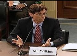
FCC Enforcement Bureau Field Resources Poised to Shrink

According to an internal FCC Enforcement Bureau (EB) memorandum, the Bureau plans to ask the full Commission to cut two-thirds of its field offices and eliminate nearly one-half of its field agents. At the same time, the Bureau would develop a so-called "Tiger Team" of field agents as a flexible strike force it could deploy as needed. In the March 10 memorandum to Enforcement Bureau field staff -- obtained by ARRL and others -- EB Chief Travis LeBlanc and FCC Managing Director Jon Wilkins cited the need to take "a fresh look" at the Bureau's 20-year-old operating model in light of technology changes and tighter budgets. ARRL CEO David Sumner, K1ZZ, expressed dismay at the proposals.

"The ARRL is concerned that there is already no sense of urgency in the FCC's enforcement activities targeting spectrum polluters, such as utilities with noisy power lines, or the few violators in our own ranks," Sumner said. "It is troubling to see recommendations for such drastic reductions in the Commission's geographic footprint and the number of field agents at a time when the Field staff is facing ever-increasing challenges."

The EB and the Office of the Managing Director initiated an effort last fall to modernize the Bureau's field operations, the memorandum said.

"This project sought to ensure that the Field's structure, operations, expenses, and equipment were properly aligned with the Commission's overall mission and resources," LeBlanc and Wilkins said. The Commission hired outside consultants to analyze the EB's current "operating model," gathering input from employees, outside experts, and internal and external stakeholders.

Under its "Phase I" field modernization scheme, the Bureau will recommend to the full Commission that it adjust the primary focus of its reduced field office complement to RF spectrum enforcement. The EB will also recommend "adjusting" the number of field agents from 63 to 33. To compensate, part of that field staff complement would include what the EB called a "Tiger Team" of agents "flexible enough to support other high-priority initiatives." Under the plan, all field agents would have to have electrical engineering backgrounds "to support the primary focus on RF spectrum enforcement." The Bureau will also propose standardizing its investigatory and sanctioning processes.

Management would not be spared. Under the recommendations, the EB field organization chart would shrink from 21 to 5 director positions, and from 10 to 3 administrative support positions.

Under the proposals, the field office would reduce its "geographic footprint," from 24 sites to 8 sites and would "pre-position" equipment in several other strategic locations. Offices slated to stay under the

FCC Managing Director Jon Wilkins testifies before the US House Subcommittee on Communications and Technology on March 4.

plan would be New York City; Columbia, Maryland -- the site of the Bureau's HF Direction-Finding Center; Chicago; Atlanta; Miami; Dallas; Los Angeles, and San Francisco. The EB would deploy equipment in or near several other cities, initially to include Kansas City, Salt Lake City, Phoenix, Seattle, San Juan, Anchorage, Honolulu, and Billings, Montana.

Part of the plan calls for the EB to establish "beneficial partnerships between the Field and other organizations that may support increasing our effectiveness."

During a March 4 US House Subcommittee on Communications and Technology Committee hearing on the FCC's FY2016 budget, Rep Michael Pompeo (R-KS) pressed Wilkins on whether the FCC intended to close any field offices and eliminate any personnel. Wilkins attempted to dodge offering a direct answer, and hedged on whether any cuts were planned. He also said the Bureau had not yet received a final report from the outside consultant it had worked with. US Rep Greg Walden, W7EQI (R-OR), chairs the subcommittee.

A copy of the memorandum was sent to National Treasury Employees Union (NTEU) Local 209 President Ana Curtis. The NTEU represents many FCC staff members.

New Legislative Issues Advocacy Fund Will Power Capitol Hill Educational Campaign

Now that the ARRL's new Legislative Issues Advocacy Fund is in place, ARRL Hudson Division Director Mike Lisenco, N2YBB -- who proposed the fund -- hopes it will fuel a heightened campaign of congressional advocacy on issues important to Amateur Radio. On behalf of the members of his Division, Lisenco earlier this year presented ARRL President Kay Craigie, N3KN, with an inaugural $4500 Fund donation, which she matched. The primary goal of the ARRL Legislative Issues Advocacy Fund is educational, Lisenco explained.

"We want to heighten Amateur Radio's visibility in Congress and to establish its brand in the minds of today's lawmakers, so we don't have to be reactive when it comes to our relationship with the federal government," Lisenco said. "It's not enough just to have a Spectrum Defense Fund. We must be recognized as effective advocates for Amateur Radio in Congress."

The immediate focus of the Legislative Issues Advocacy Fund will be the recently introduced "Amateur Radio Parity Act of 2015," officially known as H.R. 1301. US Rep Adam Kinzinger (R-IL) introduced the bill March 4 with seven Republican and five Democratic co-sponsors. Last summer Kinzinger sponsored an essentially identical piece of legislation, which died at the end of the 113th Congress.

"We're going all out for this bill," Lisenco said. "Last year, we got a late start and still picked up 69 co-sponsors. This time, we're starting early and have the entire congressional session to get this done. In addition to getting as many co-sponsors as we can in the US House, we'll be trying to get a companion bill going in the US Senate. But this effort will take money."

ARRL Hudson Division Director Mike Lisenco, N2YBB.

If Congress approves H.R. 1301, and it is signed by the president, the legislation would compel the FCC to amend the Part 97 Amateur Service rules to apply the three-part test of the PRB-1 federal pre-emption policy to include homeowners' association regulations and deed restrictions, often referred to as "covenants, conditions, and restrictions" (CC&Rs). At present, PRB-1 only applies to state and local zoning laws and ordinances. The FCC has been reluctant to extend the same legal protections to private land-use agreements without direction from Congress.

Lisenco stressed that the Legislative Issues Advocacy Fund is not simply for this particular piece of legislation and that additional actions on the part of Congress or federal regulators could also affect Amateur Radio.

"We have to have an ongoing relationship with members of Congress and their staff members," he said. "They need to know that Amateur Radio is alive and well, and flourishing in the 21st century." Lisenco pointed out that there are many more licensees today than during the 1950s and 1960s -- which some consider the Golden Age of Amateur Radio. "The Golden Age of Amateur Radio is today," he said. "We're experimenting with cutting-edge technology, and we provide a service to the community."

But, he added, if the League does not take steps now to ensure Amateur Radio's future, "there may be no future."

The Legislative Issues Advocacy Fund welcomes your support. For more information, contact Lauren Clarke, KB1YDD, tel 860-594-0348. The ARRL has an H.R. 1301 resources page on its website.

League Counters Another Mimosa Move for 10 GHz Wireless Broadband Sharing

The ARRL has told several US House and Senate members that the 10 GHz band, where the Amateur and Amateur-Satellite services have allocations, is not a suitable place to expand wireless broadband. Three Republican and three Democratic lawmakers wrote FCC Chairman Tom Wheeler on March 2, asking the Commission to "explore potential sharing opportunities within the 10 GHz band" to alleviate "the well-documented spectrum crunch." The primary allocation of 10.0-10.5 GHz is for federal radiolocation, with Amateur Radio secondary in the entire band and Amateur-Satellite secondary at 10.45 to 10.50 GHz. The League pointed out that plans for additional sharing are already in the works.

"Based on extensive compatibility studies conducted during preparations for the 2015 World Radiocommunication Conference (WRC-15), additional sharing for an important scientific purpose is already planned," ARRL CEO David Sumner, K1ZZ, pointed out in a March 4 letter to the Congress members. Sumner explained that several years of work went into an agreed-upon US proposal at WRC-15 for a primary allocation at 9.9 to 10.5 GHz for the Earth Exploration Satellite Service (active), "subject to appropriate protections for incumbent services."

Sumner said the ARRL is satisfied that the Earth Exploration Satellite Service (active) "can be accommodated in the band without causing intolerable harmful interference to the Amateur Service," while the same would not be true for wireless broadband. "Accordingly," he concluded, "the ARRL opposes the introduction of wireless broadband into the 10 GHz band."

"A request by a wireless broadband equipment manufacturer to permit broadband was considered but could not be accommodated," Sumner added. That manufacturer, Mimosa Networks, filed a Petition for Rule Making (RM-11715) in 2013 that the FCC put out for comment last year, seeking the allocation of the band for what it has called "lightly licensed fixed wireless broadband use." Mimosa's petition included a band plan for 10.0 to 10.5 GHz that would cede to Amateur Radio and Amateur-Satellite users just two small segments of the present allocation. The company claimed its proposal would protect the 10 GHz frequencies most often used by radio amateurs. The FCC has not acted on the Petition.


The ARRL told the FCC that Mimosa's Petition to permit unlicensed wireless broadband services in the 10.0-10.5 GHz band was "fatally flawed" and should be dismissed.


Sumner noted that the FCC already has initiated a proceeding to identify spectrum above 24 GHz that can be designated for mobile wireless broadband, including additional spectrum that could be authorized on an unlicensed basis.

Democratic House members Doris Matsui and Anna Eshoo, both from California, and US Senator Cory Booker of New Jersey, joined Republican House members Brett Guthrie of Kentucky and Robert Latta of Ohio, and US Senator Marco Rubio of Florida in signing the March 2 letter to Wheeler.

"Sharing opportunities in the 10 GHz band could make more spectrum available and provide another avenue for consumers and innovators to tap into the Internet economy," the lawmakers told Wheeler. Mimosa Networks expressed support for the lawmakers' appeal in a March 3 media release.

In comments to the FCC last April, the ARRL told the FCC that Mimosa's Petition to permit unlicensed wireless broadband services in the 10.0-10.5 GHz band was "fatally flawed" and should be dismissed. The League told the FCC that, among other things, the Mimosa Petition is inconsistent with a US footnote in the domestic Table of Allocations, and that fact alone is sufficient reason for the Commission to quash Mimosa's request.

The footnote prohibits all non-federal services in the 10-10.5 GHz band except for the Amateur and Amateur-Satellite services and the non-federal radiolocation service. The FCC "is not at liberty to ignore" the US footnote, the League said, and is obliged on that basis alone to dismiss the Petition, "because it hasn't the authority to grant it."

Ad
ITU Smart Sustainable Development Model Report Touts Amateur Radio's Advantages

The use of Amateur Radio in disaster preparedness and response was among "best practices" cited in the International Telecommunication Union (ITU) Smart Sustainable Development Model Report for 2015. International Amateur Radio Union (IARU) President Tim Ellam, VE6SH/G4HUA, is a member of the Smart Sustainable Development Model Advisory Board, which prepared the report, published in January. The IARU is an ITU sector member.

"I strongly believe that telecommunications and [information and communication technologies] are critical to saving lives as well as integrating communities and countries into the global economy, particularly as we enter the post-2015 development era," ITU Telecommunication Development Bureau Director Brahima Sanou said in the preface to the report, which deemed Amateur Radio operators "well suited to respond in times of crisis."

"The resource of the Amateur Radio Service should continue to be utilized as new technologies are developed," the report said. "However, the best asset the Amateur Radio Service brings to emergency communications transcends technology. It provides skilled people 'on the ground' who can communicate using whatever technology is available."

The report cited trained volunteers and existing allocated spectrum as Amateur Radio's primary resources. "Amateur Radio services can be used in any area with an active population of radio amateurs, and is uniquely suited to situations in which other communication networks have been disrupted," the report said, noting that Amateur Radio "involves a community-driven response to disasters." Read more.

Fox-1A Ready for Launch, Fox-1D to Carry Radiation-Mapping Experiment

Following successful vibration and thermal/vacuum testing, AMSAT-NA's Fox-1A CubeSat now sits in a clean environment awaiting launch, said AMSAT Vice-President-Engineering Jerry Buxton, N0JY. Fox-1A completed its Mission Readiness Review at Cal Poly in San Luis Obispo, California, on February 24 before a review board of Cal Poly and NASA representatives, he said, adding that Fox-1A delivery and integration has been set for March 25.

"From there, we won't see her again, but certainly look forward to hearing from her again," Buxton said.

Fox-1A will include a Mode B (U/V) FM transponder and capabilities similar to the AO-51 satellite, which went dark in late 2011. The first phase of the Fox series 1-Unit CubeSats will allow simple ground stations using handheld transceivers and simple dual-band antennas to make contacts. The Fox-1 CubeSats will also be able to transmit continuous telemetry during normal transponder operation.

Fox-1A is scheduled to launch in late August from Vandenberg Air Force Base in California, as part of the NASA Educational Launch of Nanosatellites (ELaNa) program, which offers free launches to educational entities and encourages science missions. Fox-1A will host a Penn State student experiment with micro-electromechanical systems (MEMS).

Elsewhere, AMSAT and University of Iowa have agreed to include the University's High Energy Radiation CubeSat Instrument (HERCI) radiation-mapping experiment on the Fox-1D CubeSat.

"HERCI is intended to provide a mapping of radiation in a low-Earth orbit," said Don Kirchner, KD0L, a University of Iowa research engineer. "This is of scientific interest for planning CubeSat test flights for low-energy X-ray detectors."

Don Kirchner, KD0L, of the University of Iowa.

The University of Iowa's history in spaceflight research dates back to the earliest satellites. As Kirchner put it, "HERCI can be considered a direct descendent of the first University of Iowa spaceflight instrument flown on Explorer I in 1958." He said the instrument is a senior design project by four UI electrical engineering students working under the supervision of the space physics engineering staff.

Buxton said the partnership is a win-win arrangement. "This partnership with the University of Iowa illustrates our strategy of leveraging the new CubeSat design to assist universities that need a way to fly scientific payloads while providing a viable ongoing platform for Amateur Radio," he said. -- Thanks to AMSAT News Service

Radio Amateurs Invited to Listen for Lambda-Sat

Lambda-Sat -- the first Greek CubeSat -- was released from the International Space Station on March 4, following its launch last summer, and its developers have invited radio amateurs around the world to listen for the Lambda-Sat signal and file reports.

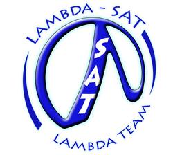
"You can help us to track and get the data from the Lambda-Sat while [it is] flying above areas not covered by our ground stations," the Lambda-Sat team said. The 1U CubeSat transmits AX.25-protocol UI packets at 1200 bps AFSK on 437.465 MHz. The 1 W transmitter identifies as KK6DFZ.

Lambda-Sat was constructed entirely by young volunteers from Greece, who traveled to Silicon Valley to participate in this project. Members of the Lambda-Sat team contributed to the construction of the satellite system through their knowledge in robotics, electronics, software development, and telecommunications.

Lambda-Sat and another CubeSat are launched into space from the International Space Station. [NASA photo]

"I want to motivate the youth in Greece to continue to dream," said the project's initiator, Periklis Papadopoulos, an aerospace engineering professor at San Jose State University. "My goal is to demonstrate the capabilities of young people in Greece."

Lambda-Sat carries an experiment that measures the radiation effects on graphene in a low-Earth orbit environment. It also carries an Automatic Identification System (AIS) receiver for tracking all marine vessels within its footprint around the globe, employing an Iridium Short Burst Data (SBD) modem and making use of the Iridium constellation.

An article on the Lambda-Sat project by Cyprus Amateur Radio Society (CARS) Secretary Nestor Jacovides, 5B4AHZ, has been posted on the CARS website.

Ad
Danish Astronaut is Among Latest Group of Space-Bound Radio Amateurs

Only one radio amateur -- Samantha Cristoforetti, IZØUDF -- is now aboard the International Space Station, but five more astronauts -- including one from Denmark -- have passed the US Technician license exam, and three of them will be among those heading to the ISS this year and next. The newest licensees are Thomas Pesquet, KG5FYG; Jack Fischer, KG5FYH; David Saint-Jacques, KG5FYI; Kathleen Rubins, KG5FYJ, and Andreas Mogensen, KG5GCZ.

Newest Astronaut-Ham: Andreas Mogensen, KG5GCZ. [NASA photo]

Pesquet joined the European Space Agency (ESA) astronaut corps in 2009. Starting in November 2016 he will serve as a flight engineer on ISS Expeditions 50 and 51. Fischer was selected in 2009 as a member of the 20th NASA astronaut class, while Saint-Jacques, selected in 2009 by the Canadian Space Agency, has moved to Houston to join the 20th NASA astronaut class. Rubins, also selected in 2009 as a member of NASA's 20th astronaut class, will serve as a flight engineer for ISS Expeditions 48 and 49, which heads to the ISS in May 2016. Mogensen, who also joined the ESA astronaut corps in 2009, has been training in Texas. When he heads to the ISS this September for a 10-day mission, he will become the first Danish astronaut to go into space. Accompanying Mogensen on the Soyuz spacecraft will be British soprano Sarah Brightman -- who has paid $52 million to be a "spaceflight participant" for 10 days -- and cosmonaut Sergei Volkov, RU3DIS.

Later this month, NASA astronaut Scott Kelly and Russian cosmonauts Mikhail Kornienko, RN3BF, and Gennady Padalka, RN3DT, will head to the ISS, and Kelly and Kornienko will remain onboard for 1 year -- the longest space mission ever assigned to a NASA astronaut. Cristoforetti will head back to Earth in May, after Kjell Lindgren, KO5MOS; Oleg Kononenko, RN3DX, and Kimiya Yui arrive at the ISS as part of a scheduled crew rotation. Read more.

ARRL Honorary Vice President, Past Director Receives BirmingHAMfest Citizenship Award

ARRL Honorary Vice President and past ARRL Southeastern Division

(L-R) Dave Cisco, W4AXL; ARRL Alabama Section Manager David Drummond, W4MD, and Frank Butler, W4RH. [Photo courtesy of David Drummond, W4MD]

Director Frank Butler, W4RH, is the recipient of the Birmingham (Alabama) Amateur Radio Club's 2015 Citizenship Award, the club's highest honor. The award recognizes outstanding service, unselfish devotion, and contributions to the club, the community, and Amateur Radio.

The recipient is selected by the club's president and the two past award recipients. Butler, of Fort Walton Beach, Florida, retired in 2008 after 50 years of elected service to the ARRL. He served as Southeastern Division Director from 1980 until 2008. Before joining the ARRL Board, Butler served briefly as the Division's Vice Director, and he was a Section Communications Manager in Florida from 1957 until 1979.

He was honored at the 2015 BirmingHAMfest.

Scientist-Radio Amateur Named to Receive Prestigious Award

Ajay K. Poddar¸ AC2KG, of Elmwood, New Jersey, has been selected by the Institute of Electrical and Electronics Engineers (IEEE) as the winner of the 2015 International Frequency Control Symposium W.G. Cady Award. Poddar, a chief scientist at Synergy Microwave Corp and an academic, was cited for "the analysis, design, and development of a host of frequency control products exhibiting state-of-the-art performance, including the development of extremely low noise crystal oscillator circuitry." The award marks the second honor for Synergy

Cady Award winner Ajay Poddar, AC2KG.

Microwave scientists this year, and the third in 3 years. Synergy Chairman Ulrich Rohde, N1UL (ex-KA2WEU), recently was named as the recipient of the IEEE's I. I. Rabi Award for 2015, and last year he won the C.B. Sawyer Memorial Award.

"In the history of the IEEE, no company ever got all three possible awards in two consecutive years in this field," Rohde said.

In his current position, Poddar is responsible for the design and development of a host of frequency-generating components and signal-processing modules that hold performance records. Poddar has received more than a dozen awards for his scientific contributions and technological innovations, holds several dozen patents, and has published more than 200 scientific papers.

Poddar and Rohde will be honored at the 2015 Joint Conference of the IEEE International Frequency Control Symposium and European Frequency and Time Forum, held April 12-16 in Denver.

Ad
Southeastern Division Assistant Director Charles I. "Chuck" Baer, W4ROA, SK

Longtime ARRL Southeastern Division Assistant Director Charles I. "Chuck" Baer, W4ROA, of Sunrise, Florida, died March 7 after a lengthy illness. He was 74. An ARRL member, Baer had served three ARRL Southeastern Division directors over the years.

Chuck Baer, W4ROA.

"Chuck and I have worked together for over 30 years with local ARRL affairs," said ARRL Southern Florida Section Manager Jeff Beals, WA4AW. "He was very active in the Broward County Amateur Radio community."

Originally licensed KN9TVA in 1959 when he was 17, Baer worked at Allied Radio in Chicago before moving to South Florida to work for Motorola at the company's Plantation manufacturing facility.

"He led the team that produced the Amateur Radio gear for the Space Shuttle program," said Beals. "Chuck was a founding member of the Motorola Amateur Radio Club W4MOT and served as repeater trustee for many years." Baer retired from Motorola after nearly 3 decades of service.

Baer was a member of the South Florida DX Association, the Broward Amateur Radio Club, the Palmetto Amateur Radio Club, and the ARRL A-1 Operators Club. He served as an ARRL Official Observer for more than 50 years in Illinois and Florida.

In Brief...

Yasme Foundation Elects Two Directors: The Yasme Foundation Board of Directors has announced the election of Ken Claerbout, K4ZW, and Hans Blondeel Timmerman, PB2T, to the Board, effective with the Foundation's upcoming Annual Meeting in Visalia, California. The action brings the number of directors to nine. The Yasme Foundation is a not-for-profit corporation organized to conduct scientific and educational projects related to Amateur Radio, including DXing and the introduction and promotion of Amateur Radio in developing countries.


The K7RA Solar Update

Tad Cook, K7RA, Seattle, reports: For the second week in a row, average daily sunspot numbers were down. According to ARRL Propagation Bulletins 6-11, the average sunspot numbers were 139, 81.6, 54.6, 59, and 54.1, respectively. Over the past week the number was all the way down to 32.

On the other hand, for the second week in a row, average daily solar flux trended upward. Average daily solar flux numbers reported in ARRL Propagation Bulletins 6-11 were 151.1, 144.1, 121.4, 116.3, 122.9, and 127.8, respectively. These averages cover the dates from January 29 through March 11.

Predicted solar flux is 125 on March 12-15, 130 on March 16-18, 125 on March 19, 120 on March 20-21, 115 on March 22-23, 110 on March 24-27, and 115 on March 28-31. Solar flux then goes to a high of 125 on April 2-15 before again dropping to a low of 110 for April 20-23.

Predicted planetary A index is 18, 30, 18 and 8 on March 12-15, then 20, 18, and 12 on March 16-18, 5 on March 19-21, then 15, 20 and 8 on March 22-24, 5 on March 25-26, then 15, 30, 25, 12, and 10 on March 27-31, then 8, 10, 15, 12, 18, and 12 on April 1-6, 8 on April 7-8, and 10 on April 9-10. Looking all the way out toward the end of the 45-day forecast, planetary A index for April 24 is expected to be 30. As you can see, forecasters predict active geomagnetic conditions similar to those seen as previous solar cycles have turned down. The current sunspot cycle peaked about 1 year ago.

This weekly "Solar Update" in The ARRL Letter is a preview of the "Propagation Bulletin" issued each Friday. The latest bulletin and an archive of past propagation bulletins is on the ARRL website.

In Friday's bulletin, look for an updated forecast and an update on our 3-month moving average of daily sunspot numbers. Send me your reports and observations. -- Tad Cook, K7RA

Getting It Right!

A photo caption in the story, "Amateur Radio Parity Act of 2015 Introduced in Congress," which appeared in The ARRL Letter of March 5, 2015, contained incorrect information. The caption should have said: US Rep Adam Kinzinger (R-IL) introduced "The Amateur Radio Parity Act of 2015" on March 4.

"Just Ahead in Radiosport" in The ARRL Letter of March 5, 2015, contained incorrect dates for the Africa All-Mode International DX Contest. The contest will take place over the March 14-15 weekend.


Just Ahead in Radiosport
  • March 14 -- AGCW QRP Contest (CW)

  • March 14 -- QRP ARCI Spring Digital Sprint

  • March 14-15 -- Africa All-Mode International DX Contest

  • March 14-15 -- RSGB Commonwealth Contest (CW)

  • March 14-15 -- Louisiana QSO Party

  • March 14-15 -- EA PSK63 Contest

  • March 14-15 -- Tesla Memorial HF Contest (CW)

  • March 14-15 -- QCWA Spring QSO Party

  • March 14-15 -- Idaho QSO Party

  • March 15 -- North American RTTY Sprint

  • March 15-16 -- Wisconsin QSO Party

  • March 16 -- PODXS St Patrick's Day Contest (Digital)

  • March 16 -- Run For the Bacon (CW)

  • March 17 -- CLARA Chatter Party (SSB, CW)

  • March 19 -- NAQCC Monthly QRP Sprint (CW)

See the ARRL Contest Calendar for more information.


Upcoming ARRL Section, State, and Division Conventions and Events

Find conventions and hamfests in your area.

Ad
Ad
Ad
Ad
Ad


The ARRL Letter is published Thursdays, 48 times each year. ARRL members may subscribe at no cost or unsubscribe by editing their Member Data Page as described at http://www.arrl.org/arrlletter/.

Copyright © 2015 American Radio Relay League, Inc. All Rights Reserved

www.arrl.org

On the Radio Florida Orange's are the The Roundup


ASUS42 KMLB 121911
RWRMLB
HOURLY WEATHER ROUNDUP AROUND FLORIDA
NATIONAL WEATHER SERVICE OFFICE MELBOURNE FL
300 PM EDT THU MAR 12 2015

CITY           SKY/WX    TMP DP  RH WIND       PRES   REMARKS
MELBOURNE      MOSUNNY   81  69  67 E15       30.17F
FORT PIERCE    MOSUNNY   82  70  66 E17G25    30.17F
ORLANDO INTL   PTSUNNY   86  63  45 E8        30.16F
DAYTONA BEACH  PTSUNNY   83  68  60 E10       30.18F
VERO BEACH     MOSUNNY   82  69  64 SE15      30.17
$$
...ELSEWHERE ACROSS CENTRAL FLORIDA...

CITY           SKY/WX    TMP DP  RH WIND       PRES   REMARKS
PATRICK AFB    MOSUNNY   79  72  79 E8        30.17F
KSC            MOSUNNY   83  67  59 SE10G17   30.17F
CAPE CANAVERAL MOSUNNY   80  69  70 SE13G18   30.17F
ORLANDO EXEC   MOSUNNY   84  62  47 E7        30.16F
LEESBURG       PTSUNNY   83  64  52 W5        30.18F
THE VILLAGES     N/A     84  64  51 E7        30.07F
SANFORD        PTSUNNY   86  62  44 E10       30.16F
DELAND           N/A    N/A N/A N/A E6        30.17F
NEW SMYRNA BCH MOSUNNY   82  66  57 E12G17    30.19F
ORMOND BEACH   MOSUNNY   81  68  65 E8        30.18F
WINTER HAVEN   MOSUNNY   85  60  42 E13       30.16F
OKEECHOBEE     PTSUNNY   86  66  51 SE10      30.15F
TAMPA          PTSUNNY   86  62  44 VRB3      30.14F
$$
...NORTHERN FLORIDA...

CITY           SKY/WX    TMP DP  RH WIND       PRES   REMARKS
PALM COAST     PTCLDY    84  70  61 SE10      30.18F
ST AUGUSTINE   MOSUNNY   77  70  79 SE12      30.19F
OCALA          PTSUNNY   82  66  57 SE5       30.18F
GAINESVILLE    PTSUNNY   84  66  54 SE9       30.17F
JACKSONVILLE   CLOUDY    73  70  90 NE10      30.20F
TALLAHASSEE    CLOUDY    83  68  60 VRB6      30.16F
$$
...ALONG THE SOUTHEAST COAST TO THE KEYS...

CITY           SKY/WX    TMP DP  RH WIND       PRES   REMARKS
STUART         PTSUNNY   79  68  69 E14G20    30.18F
WEST PALM BCH  MOSUNNY   83  70  64 E15G24    30.15F
MIAMI          PTSUNNY   83  66  56 SE17G25   30.14F
KEY WEST       CLOUDY    80  69  69 E18G29    30.11F
$$
...MARINE REPORTS...

STATION/POSITION TIME  TEMP    WIND        PRES    WAVE   SWELL
                       AIR SEA DIR/SP/G            HT/PER HT/PER/DIR
                 (UTC) (F)     (DEG/KT/KT) (MB)    (FT/S) (FT/S/D)
ST AUGUSTINE FP  1900   65 57  150/  5/  6 1023.1F
20NM E CAPE CANA 1820   76 75  140/  8/  8 1023.0F
120 E NEW SMYRNA 1820   75 76  130/  6/  6 1023.9F
TRIDENT PIER     1800   79 70  120/  5/  8 1023.5F
SEBASTIAN INLET  1800   75     120/ 10     1023.0F
4NM E PORT CANAV 1809      74                N/A     2/ 8
6NM NE FPR INLET 1825      76                N/A     3/ 9
SETTLEMENT PT GB 1900   79     120/ 10/ 11 1022.2F
$$

  [top]

000
ASUS42 KKEY 121910
RWRKEY

FLORIDA REGIONAL WEATHER ROUNDUP FOR THE FLORIDA KEYS
NATIONAL WEATHER SERVICE KEY WEST FLORIDA
300 PM EDT THU MAR 12 2015

...SOUTH FLORIDA AND THE KEYS...

CITY           SKY/WX    TMP DP  RH WIND       PRES   REMARKS
FORT MYERS     MOSUNNY   88  61  40 E9        30.10F
SW REGIONAL AP MOSUNNY   89  60  37 SE16G22   30.10F
NAPLES         MOSUNNY   86  62  44 SE12      30.09F
MIAMI          PTSUNNY   83  66  56 SE17G25   30.14F
WEST KENDALL   MOSUNNY   83  69  62 E17G25    30.14F
HOMESTEAD      MOSUNNY   82  71  68 E15G23    30.14F
MARATHON       MOSUNNY   84  74  71 E10G18    30.12F HX  91
BOCA CHICA NAS PTSUNNY   80  67  64 E16       30.11F
KEY WEST INTL  CLOUDY    80  69  69 E18G29    30.11F

...INTERNATIONAL WEATHER...

CITY           SKY/WX    TMP DP  RH WIND       PRES   REMARKS
NASSAU BAHAMAS MOSUNNY   82  66  57 E12       30.17F
CANCUN MEXICO  PTSUNNY   84  73  70 E12       30.03F HX  91
COZUMEL MEXICO PTSUNNY   82  70  65 E7        30.02F

ADJACENT COASTAL WATERS...

STATION/POSITION TIME  SKY/WX   TEMP    WIND        PRES    WAVE
                                AIR SEA DIR/SP/G            HT/PER
                 (UTC)          (F)     (DEG/KT/KT) (MB)    (FT/S)
PULASKI SHOAL LI 1800            77     120/ 19/ 23 1019.4F
SAND KEY         1850            77     100/ 19/ 23 1019.2F
SOMBRERO KEY     1900            78     110/ 17/ 18 1020.3F
LONG KEY         1900            78 80  110/ 16/ 19 1020.6F
MOLASSES REEF    1900            77 78  110/ 16/ 18 1020.0F
FOWEY ROCKS      NOT AVBL
Buoy 42080       NOT AVBL

$$

  [top]

000
ASUS42 KTBW 121910
RWRFL
FLORIDA REGIONAL WEATHER ROUNDUP
NATIONAL WEATHER SERVICE TAMPA BAY RUSKIN FL
300 PM EDT THU MAR 12 2015

NOTE: "FAIR" INDICATES FEW OR NO CLOUDS BELOW 12,000 FEET WITH NO
SIGNIFICANT WEATHER AND/OR OBSTRUCTIONS TO VISIBILITY.

FLZ001>010-012>015-112-114-115-122000-
PANHANDLE FLORIDA

CITY           SKY/WX    TMP DP  RH WIND       PRES   REMARKS
PENSACOLA      CLOUDY    68  67  96 E5        30.16F
PENSACOLA NAS  FOG       67  67 100 NE9       30.15F VSB 1/4
MILTON NAS     CLOUDY    72  68  87 SE7       30.17S
CRESTVIEW      CLOUDY    76  68  76 S8        30.18F
DUKE FIELD     CLOUDY    75  68  78 S10       30.15F
VALPARAISO     CLOUDY    69  68  98 SE9       30.15F
MARY ESTHER    CLOUDY    70  61  71 E9        30.14F
TRI COUNTY     FAIR      77  68  73 S6        30.17F
PANAMA CITY    CLOUDY    75  68  78 SE7       30.15F
TYNDALL AFB    CLOUDY    75  70  85 S8        30.16F
APALACHICOLA   CLOUDY    76  68  76 SE7       30.18F

STATION/POSITION SKY/WX   TEMP    WIND        PRES    WAVE   SWELL
                          AIR SEA DIR/SP/G            HT/PER HT/PER
                          (F)     (DEG/KT/KT) (MB)    (FT/S) (FT/S)
30.1N   87.6W              66 66   50/ 10/ 12 1019.7F   3/ 4   2/ 7
29.2N   88.2W              72 70  130/ 16/ 19 1019.2    5/ 5
28.7N   86.0W              72 74  120/ 12/ 14 1021.0F   3/ 6   2/ 6
PANAMA CITY BEAC           66 64  120/  5/  5 1021.2F
CAPE SAN BLAS    NOT AVBL
TOWER C                    66     100/ 10/ 10 1021.4F
28.5N   84.5W              72 70  120/  8/ 10 1021.3F   2/ 6   2/ 6

$$
FLZ011-016>038-118-127-128-134-139-239-122000-
NORTH FLORIDA

CITY           SKY/WX    TMP DP  RH WIND       PRES   REMARKS
MARIANNA       CLOUDY    79  67  66 VRB5      30.16F
TALLAHASSEE    CLOUDY    83  68  60 VRB6      30.16F
CROSS CITY       N/A     81  70  69 W7        30.15F
LAKE CITY      CLOUDY    79  70  73 E6        30.18F
GAINESVILLE    PTSUNNY   84  66  54 SE9       30.17F
MAYPORT NAS    CLOUDY    66  64  93 N6        30.21F FOG
JACKSONVILLE   CLOUDY    73  70  90 NE10      30.20F
JAX NAS        PTSUNNY   82  69  64 NE13      30.19F
JAX CRAIG      CLOUDY    73  67  81 NE10      30.20F
JAX CECIL      PTSUNNY   82  68  61 NE7       30.19F
FERNANDINA BEA CLOUDY    72  68  88 NE7       30.21F
ST AUGUSTINE   MOSUNNY   77  70  79 SE12      30.19F

STATION/POSITION SKY/WX   TEMP    WIND        PRES    WAVE   SWELL
                          AIR SEA DIR/SP/G            HT/PER HT/PER
                          (F)     (DEG/KT/KT) (MB)    (FT/S) (FT/S)
SHELL POINT                74     170/  4/  6   N/A
KEATON BEACH               73     210/  7/  9 1021.5F
CEDAR KEY                  75     260/  2/  3 1021.8F
FERNANDINA                         10/  5/  9 1022.7F
30.7N   81.3W                 60                N/A     2/ 9
MAYPORT                            40/  7/  8 1023.0F
31.4N   80.9W              61 56   40/ 12/ 14 1024.2F   3/ 9   2/ 9
ST AUGUSTINE               65 57  150/  5/  6 1023.1F

$$
FLZ040-043>046-052-053-057-058-063-144-122000-
INTERIOR CENTRAL FLORIDA

CITY           SKY/WX    TMP DP  RH WIND       PRES   REMARKS
OCALA          PTSUNNY   82  66  57 SE5       30.18F
THE VILLAGES     N/A     84  64  51 E7        30.07F
LEESBURG       PTSUNNY   83  64  52 W5        30.18F
SANFORD        PTSUNNY   86  62  44 E10       30.16F
ORLANDO EXEC   MOSUNNY   84  62  47 E7        30.16F
ORLANDO INTL   PTSUNNY   86  63  45 E8        30.16F
WINTER HAVEN   MOSUNNY   85  60  42 E13       30.16F
LAKELAND       PTSUNNY   88  63  42 E12       30.15F
BARTOW         PTSUNNY   86  61  42 E12G17    30.15F
OKEECHOBEE     PTSUNNY   86  66  51 SE10      30.15F

$$
FLZ041-047-054-059-064-141-147-122000-
EAST CENTRAL FLORIDA

CITY           SKY/WX    TMP DP  RH WIND       PRES   REMARKS
ORMOND BEACH   MOSUNNY   81  68  65 E8        30.18F
DAYTONA BEACH  PTSUNNY   83  68  60 E10       30.18F
DELAND           N/A    N/A N/A N/A E6        30.17F
NEW SMYRNA BEA MOSUNNY   82  66  57 E12G17    30.19F
JFK SPACE CTR  MOSUNNY   83  67  59 SE10G17   30.17F
TITUSVILLE     MOSUNNY   82  66  57 SE13      30.19F
CAPE CANAVERAL MOSUNNY   80  69  70 SE13G18   30.17F
PATRICK AFB    MOSUNNY   79  72  79 E8        30.17F
MELBOURNE      MOSUNNY   81  69  67 E15       30.17F
VERO BEACH     MOSUNNY   82  69  64 SE15      30.17F
FT PIERCE      MOSUNNY   82  70  66 E17G25    30.17F
STUART         PTSUNNY   79  68  69 E14G20    30.18F

STATION/POSITION SKY/WX   TEMP    WIND        PRES    WAVE   SWELL
                          AIR SEA DIR/SP/G            HT/PER HT/PER
                          (F)     (DEG/KT/KT) (MB)    (FT/S) (FT/S)
28.5N   80.2W              76 75  140/  8/  8 1023.0F
28.9N   78.5W              75 76  120/  6/  8 1023.5F   3/ 8   3/ 8
TRIDENT PIER                      100/  4/  8 1022.7F
28.4N   80.5W                 74                N/A     2/ 9
27.6N   80.2W                 76                N/A     3/ 4

$$
FLZ050-056-061-142-242-148-248-149-249-151-251-155-255-
160-260-122000-
WEST CENTRAL FLORIDA

CITY           SKY/WX    TMP DP  RH WIND       PRES   REMARKS
CRYSTAL RIVER  MOCLDY    86  61  42 SE3       30.16F
INVERNESS      FAIR      86  61  42 E6        30.16F
BROOKSVILLE    CLOUDY    87  63  44 E10       30.16F
ZEPHYRHILLS    MOCLDY    86  59  39 NE8       30.16F
CLEARWATER     MOSUNNY   84  68  58 NE7       30.14F
TAMPA INTL     PTSUNNY   86  62  44 VRB3      30.14F
TAMPA EXEC     MOSUNNY   88  63  42 E5        30.14F
PLANT CITY     PTSUNNY  N/A N/A N/A SE8       30.16F
MACDILL AFB    SUNNY     87  67  51 S10       30.13F
PETER O KNIGHT PTSUNNY   90  64  43 SE7       30.14F
ST PETERSBURG  SUNNY     83  67  58 NE8       30.12F
SARASOTA       MOSUNNY   86  62  44 E13       30.12F
VENICE         FAIR      86  63  45 SE12G17   30.12F

STATION/POSITION SKY/WX   TEMP    WIND        PRES    WAVE   SWELL
                          AIR SEA DIR/SP/G            HT/PER HT/PER
                          (F)     (DEG/KT/KT) (MB)    (FT/S) (FT/S)
CEDAR KEY                  75     260/  2/  3 1021.8F
28.5N   84.5W              72 70  120/  8/ 10 1021.3F   2/ 6   2/ 6
27.3N   84.3W                 73                N/A     3/ 4
CLEARWATER BEACH           82 70  110/  8/ 11 1020.8F
MIDDLE TAMPA BAY                  120/  7/  8 1020.8F
VENICE                     79 73  200/  7/  9 1019.4F

$$
FLZ066-069-070-075>078-162-262-165-265-122000-
SOUTHWEST FLORIDA AND KEYS

CITY           SKY/WX    TMP DP  RH WIND       PRES   REMARKS
PUNTA GORDA    SUNNY     87  62  43 SE13      30.13F
FT MYERS       MOSUNNY   88  61  40 E9        30.10F
SOUTHWEST INTL MOSUNNY   89  60  37 SE16G22   30.10F
NAPLES         MOSUNNY   86  62  44 SE12      30.09F
MARCO ISLAND   MOCLDY    86  66  51 SE8       30.10F
IMMOKALEE      PTCLDY   N/A N/A N/A E13       30.12F
MARATHON       MOSUNNY   84  74  71 E10G18    30.12F
KEY WEST NAS   PTSUNNY   80  67  64 E16       30.11F
KEY WEST INTL  CLOUDY    80  69  69 E18G29    30.11F

STATION/POSITION SKY/WX   TEMP    WIND        PRES    WAVE   SWELL
                          AIR SEA DIR/SP/G            HT/PER HT/PER
                          (F)     (DEG/KT/KT) (MB)    (FT/S) (FT/S)
VENICE                     79 73  200/  7/  9 1019.4F
NAPLES                     80 75  230/  2/  4 1019.1F
26.0N   85.6W              78 79  130/ 14/ 16 1018.8F   5/ 7   3/ 7
DRY TORTUGAS               77     120/ 19/ 23 1019.4F
NW FL BAY                  79     130/ 15/ 20 1021.3F
SAND KEY                   77     100/ 19/ 23 1019.2F
SOMBRERO KEY               78     110/ 17/ 18 1020.3F
LONG KEY                   78 80  110/ 16/ 19 1020.6F
MOLASSES REEF              77 78  110/ 16/ 18 1020.0F

$$
FLZ067-068-071>074-168-172>174-122000-
SOUTHEAST FLORIDA

CITY           SKY/WX    TMP DP  RH WIND       PRES   REMARKS
W PALM BEACH   MOSUNNY   83  70  64 E15G24    30.15F
FT LAUDER-EXEC MOSUNNY   83  70  64 E16G24    30.14F
FT LAUDERDALE  MOSUNNY   82  72  71 SE14      30.14F
POMPANO BEACH  MOSUNNY   84  71  65 E14       30.15F
PEMBROKE PINES MOSUNNY   85  68  56 E15       30.15F
OPA LOCKA      MOSUNNY   84  68  58 E16       30.15F
MIAMI          PTSUNNY   83  66  56 SE17G25   30.14F
WEST KENDALL   MOSUNNY   83  69  62 E17G25    30.14F
HOMESTEAD      MOSUNNY   82  71  68 E15G23    30.14F

STATION/POSITION SKY/WX   TEMP    WIND        PRES    WAVE   SWELL
                          AIR SEA DIR/SP/G            HT/PER HT/PER
                          (F)     (DEG/KT/KT) (MB)    (FT/S) (FT/S)
PORT EVERGLADES            81     120/  6/  9 1021.0
VIRGINIA KEY               78 79  100/ 11/ 13 1020.6F
LAKE WORTH                 77 77  110/ 11/ 13 1021.1F

000
ASUS42 KKEY 121910
RWRKEY

FLORIDA REGIONAL WEATHER ROUNDUP FOR THE FLORIDA KEYS
NATIONAL WEATHER SERVICE KEY WEST FLORIDA
300 PM EDT THU MAR 12 2015

...SOUTH FLORIDA AND THE KEYS...

CITY           SKY/WX    TMP DP  RH WIND       PRES   REMARKS
FORT MYERS     MOSUNNY   88  61  40 E9        30.10F
SW REGIONAL AP MOSUNNY   89  60  37 SE16G22   30.10F
NAPLES         MOSUNNY   86  62  44 SE12      30.09F
MIAMI          PTSUNNY   83  66  56 SE17G25   30.14F
WEST KENDALL   MOSUNNY   83  69  62 E17G25    30.14F
HOMESTEAD      MOSUNNY   82  71  68 E15G23    30.14F
MARATHON       MOSUNNY   84  74  71 E10G18    30.12F HX  91
BOCA CHICA NAS PTSUNNY   80  67  64 E16       30.11F
KEY WEST INTL  CLOUDY    80  69  69 E18G29    30.11F

...INTERNATIONAL WEATHER...

CITY           SKY/WX    TMP DP  RH WIND       PRES   REMARKS
NASSAU BAHAMAS MOSUNNY   82  66  57 E12       30.17F
CANCUN MEXICO  PTSUNNY   84  73  70 E12       30.03F HX  91
COZUMEL MEXICO PTSUNNY   82  70  65 E7        30.02F

ADJACENT COASTAL WATERS...

STATION/POSITION TIME  SKY/WX   TEMP    WIND        PRES    WAVE
                                AIR SEA DIR/SP/G            HT/PER
                 (UTC)          (F)     (DEG/KT/KT) (MB)    (FT/S)
PULASKI SHOAL LI 1800            77     120/ 19/ 23 1019.4F
SAND KEY         1850            77     100/ 19/ 23 1019.2F
SOMBRERO KEY     1900            78     110/ 17/ 18 1020.3F
LONG KEY         1900            78 80  110/ 16/ 19 1020.6F
MOLASSES REEF    1900            77 78  110/ 16/ 18 1020.0F
FOWEY ROCKS      NOT AVBL
Buoy 42080       NOT AVBL

$$
S$™

Wednesday, March 11, 2015

City Weather

Selected Cities

SELECTED CITIES WEATHER SUMMARY AND FORECASTS...PART 1 OF 4
NWS/NDFD TELECOMMUNICATION OPERATIONS CENTER SILVER SPRING MD
850 AM EDT WED MAR 11 2015

TEMPERATURES INDICATE DAYTIME HIGH...NIGHTTIME LOW
B INDICATES TEMPERATURES BELOW ZERO
PRECIPITATION FOR 24 HOURS ENDING AT 8 AM EDT

                                FORECAST        FORECAST
                 TUE...MAR 10   WED....MAR 11   THU....MAR 12
CITY             HI/LO   PCPN   WEA     HI/LO   WEA     HI/LO

ABILENE TX       63  37         SUNNY   69/43   SUNNY   68/44
AKRON CANTON     45  37   .20   PTCLDY  46/26   SUNNY   49/35
ALBANY NY        49  37   .03   PTCLDY  46/27   SUNNY   39/19
ALBUQUERQUE      65  41         PTCLDY  69/39   MOCLDY  64/39
ALLENTOWN        46  36   .37   MOCLDY  53/31   SUNNY   50/25
AMARILLO         69  37         SUNNY   72/36   SUNNY   71/40
ANCHORAGE        20  08         SUNNY   17/05   SUNNY   14/02
ASHEVILLE        67  54    MM   SHWRS   65/49   RAIN    53/42
ATLANTA          79  58         SHWRS   73/57   SHWRS   68/50
ATLANTIC CITY    59  46   .34   MOCLDY  62/33   SUNNY   51/26
AUSTIN           64  54         MOCLDY  67/51   MOCLDY  71/48
BALTIMORE        49  43   .50   RAIN    60/35   SUNNY   54/32
BATON ROUGE      72  61   .24   SHWRS   71/63   SHWRS   74/63
BILLINGS         66  42         MOCLDY  72/43   MOCLDY  65/36
BIRMINGHAM       72  61   .50   SHWRS   69/58   SHWRS   73/59
BISMARCK         56  27         PTCLDY  66/36   MOCLDY  65/36
BOISE            71  50         CLOUDY  61/44   MOCLDY  65/36
BOSTON           46  37   .07   PTCLDY  54/31   SUNNY   39/22
BRIDGEPORT       41  35   .26   PTCLDY  53/29   SUNNY   46/22
BROWNSVILLE      65  59   .13   MOCLDY  67/56   PTCLDY  76/56
BUFFALO          47  34         PTCLDY  38/25   PTCLDY  38/25
BURLINGTON VT    49  41         MOCLDY  46/24   PTCLDY  30/13
CARIBOU          39  32         MOCLDY  43/14   MOCLDY  22/02
CASPER           57  34         WINDY   60/37   MOCLDY  53/31
CHARLESTON SC    81  63         MOCLDY  83/61   CLOUDY  67/54
CHARLESTON WV    60  53  1.00   MOCLDY  62/38   SUNNY   65/47
CHARLOTTE        78  58         SHWRS   76/52   CLOUDY  57/45
CHATTANOOGA      68  59   .20   SHWRS   67/54   SHWRS   66/53
CHEYENNE         58  29         SUNNY   64/35   MOCLDY  57/35
CHICAGO          51  30         SUNNY   50/28   SUNNY   52/37
CINCINNATI       51  44   .83   PTCLDY  58/35   SUNNY   58/46
CLEVELAND        45  36   .03   MOCLDY  39/28   SUNNY   45/35
COLORADO SPGS    62  30         SUNNY   64/37   PTCLDY  64/38
COLUMBIA SC      83  61         MOCLDY  83/59   CLOUDY  63/48
COLUMBUS GA      83  57         MOCLDY  79/61   SHWRS   77/57
COLUMBUS OH      47  38   .47   PTCLDY  52/30   SUNNY   55/39

$$
SELECTED CITIES WEATHER SUMMARY AND FORECASTS...PART 2 OF 4
NWS/NDFD TELECOMMUNICATION OPERATIONS CENTER SILVER SPRING MD
850 AM EDT WED MAR 11 2015

TEMPERATURES INDICATE DAYTIME HIGH...NIGHTTIME LOW
B INDICATES TEMPERATURES BELOW ZERO
PRECIPITATION FOR 24 HOURS ENDING AT 8 AM EDT

                                FORECAST        FORECAST
                 TUE...MAR 10   WED....MAR 11   THU....MAR 12
CITY             HI/LO   PCPN   WEA     HI/LO   WEA     HI/LO

CONCORD NH       50  31   .07   PTCLDY  52/25   SUNNY   37/15
CORPUS CHRISTI   68  55         MOCLDY  68/53   MOCLDY  71/53
DALLAS FT WORTH  59  44         PTCLDY  71/49   MOCLDY  67/50
DAYTON           49  35   .55   PTCLDY  50/31   SUNNY   55/42
DAYTONA BEACH    85  65         PTCLDY  83/66   MOCLDY  80/66
DENVER           62  33         SUNNY   68/34   PTCLDY  64/36
DES MOINES       70  38         SUNNY   68/41   SUNNY   71/44
DETROIT          48  33         SUNNY   52/28   SUNNY   44/29
DULUTH           58  29         MOCLDY  45/34   MOCLDY  50/35
EL PASO          72  45         SUNNY   73/44   PTCLDY  71/47
ELKINS           46  46  1.44   RAIN    60/29   SUNNY   60/38
ERIE             47  38         MOCLDY  37/28   SUNNY   36/29
EUGENE           63  49   .09   RAIN    61/47   PTCLDY  65/38
EVANSVILLE       54  45   .74   PTCLDY  63/41   MOCLDY  61/50
FAIRBANKS        00  27B        VRYCLD  00/26B  VRYCLD B01/25B
FARGO            58  28         PTCLDY  56/40   PTCLDY  62/37
FLAGSTAFF        59  23         MOCLDY  58/28   MOCLDY  55/28
FLINT            48  33         SUNNY   50/27   PTCLDY  48/30
FORT SMITH       58  38         SUNNY   73/47   MOCLDY  64/51
FORT WAYNE       46  34         MOCLDY  50/28   SUNNY   53/35
FRESNO           82  61         MOCLDY  71/48   SUNNY   73/49
GOODLAND         68  31         SUNNY   72/35   SUNNY   74/38
GRAND JUNCTION   63  32         PTCLDY  63/35   MOCLDY  58/36
GRAND RAPIDS     44  28         SUNNY   47/27   SUNNY   49/33
GREAT FALLS      65  41         MOCLDY  65/40   PTCLDY  61/35
GREEN BAY        55  31         PTCLDY  49/27   SUNNY   51/34
GREENSBORO       71  61         SHWRS   70/48   PTCLDY  58/42
HARRISBURG       50  36   .50   MOCLDY  55/32   SUNNY   50/30
HARTFORD SPGFLD  52  36   .14   PTCLDY  55/29   SUNNY   43/22
HELENA           68  33         MOCLDY  65/42   PTCLDY  63/36
HONOLULU         80  68   .01   MOCLDY  76/64   SUNNY   76/64
HOUSTON INTCNTL  60  53         CLOUDY  62/54   CLOUDY  66/52
HUNTSVILLE AL    70  61  1.09   SHWRS   68/54   RAIN    68/55
INDIANAPOLIS     49  34   .30   PTCLDY  55/35   PTCLDY  58/43
JACKSON MS       74  57   .90   CLOUDY  67/60   RAIN    74/63
JACKSONVILLE     86  64         MOCLDY  82/64   MOCLDY  78/61
JUNEAU           34  21   .01   PTCLDY  32/26   SNOW    39/37
KANSAS CITY      71  42         SUNNY   71/46   PTCLDY  70/45
KEY WEST         82  77         MOCLDY  82/76   PTCLDY  83/76
KNOXVILLE        68  59   .11   SHWRS   67/50   MOCLDY  68/52
LAKE CHARLES     62  56   .08   SHWRS   64/60   SHWRS   70/58
LANSING          47  32         SUNNY   47/28   SUNNY   49/33
LAS VEGAS        77  57         MOCLDY  74/55   PTCLDY  78/54
LEXINGTON        60  48  1.05   MOCLDY  61/41   PTCLDY  59/49

$$
SELECTED CITIES WEATHER SUMMARY AND FORECASTS...PART 3 OF 4
NWS/NDFD TELECOMMUNICATION OPERATIONS CENTER SILVER SPRING MD
850 AM EDT WED MAR 11 2015

TEMPERATURES INDICATE DAYTIME HIGH...NIGHTTIME LOW
B INDICATES TEMPERATURES BELOW ZERO
PRECIPITATION FOR 24 HOURS ENDING AT 8 AM EDT

                                FORECAST        FORECAST
                 TUE...MAR 10   WED....MAR 11   THU....MAR 12
CITY             HI/LO   PCPN   WEA     HI/LO   WEA     HI/LO

LINCOLN          74  28         SUNNY   71/40   SUNNY   72/41
LITTLE ROCK      58  52         PTCLDY  65/51   SHWRS   61/56
LOS ANGELES      80  60         MOCLDY  74/56   SUNNY   82/58
LOUISVILLE       56  47  1.18   MOCLDY  63/42   PTCLDY  61/49
LUBBOCK          71  38         SUNNY   72/37   SUNNY   71/40
MACON            81  54         MOCLDY  81/60   SHWRS   75/54
MADISON          56  28         SUNNY   53/28   SUNNY   58/36
MEDFORD          59  49   .10   SHWRS   59/45   SUNNY   70/41
MEMPHIS          59  52   .13   MOCLDY  63/51   RAIN    64/59
MIAMI BEACH      84  76   .15   PTCLDY  83/75   PTCLDY  85/74
MIDLAND ODESSA   69  41         SUNNY   71/39   SUNNY   70/41
MILWAUKEE        55  38         SUNNY   46/30   SUNNY   47/35
MPLS ST PAUL     66  29         SUNNY   57/39   SUNNY   67/44
MISSOULA         66  33         CLOUDY  61/36   MOCLDY  57/29
MOBILE           76  62   .17   SHWRS   76/62   SHWRS   74/63
MONTGOMERY       86  58         SHWRS   77/60   SHWRS   80/61
NASHVILLE        68  53   .37   MOCLDY  65/47   RAIN    66/55
NEW ORLEANS      76  61  2.40   SHWRS   73/63   SHWRS   75/63
NEW YORK CITY    53  43   .47   MOCLDY  55/33   SUNNY   47/28
NEWARK           53  42   .43   MOCLDY  55/33   SUNNY   49/26
NORFOLK VA       72  64         RAIN    66/43   SUNNY   47/35
NORTH PLATTE     71  21         SUNNY   75/31   SUNNY   75/37
OKLAHOMA CITY    68  44         SUNNY   73/45   SUNNY   70/45
OMAHA            71  30         SUNNY   70/42   SUNNY   72/41
ORLANDO          87  68         MOCLDY  87/68   PTCLDY  84/65
PADUCAH          56  49  1.11   MOCLDY  63/46   MOCLDY  61/51
PENDLETON        76  50         CLOUDY  62/45   PTCLDY  63/38
PEORIA           61  33         SUNNY   61/35   SUNNY   64/42
PHILADELPHIA     59  44   .71   MOCLDY  60/35   SUNNY   52/31
PHOENIX          87  59         MOCLDY  88/64   PTCLDY  85/61
PITTSBURGH       45  41   .51   MOCLDY  48/30   SUNNY   50/35
POCATELLO        65  34         MOCLDY  65/40   MOCLDY  60/33
PORTLAND ME      47  39         SUNNY   51/28   SUNNY   37/15
PORTLAND OR      65  52         RAIN    58/47   MOCLDY  65/39
PROVIDENCE       44  36   .27   PTCLDY  55/30   SUNNY   42/22
PUEBLO           66  27         SUNNY   72/34   PTCLDY  72/38
RALEIGH DURHAM   75  60         SHWRS   76/49   SUNNY   58/40
RAPID CITY       64  30         SUNNY   74/38   PTCLDY  70/40
RENO             70  54         SHWRS   61/37   SUNNY   63/34
RICHMOND         63  56   .05   RAIN    65/42   SUNNY   57/34
ROANOKE          58  53   .04   RAIN    67/44   PTCLDY  55/37
ROCHESTER NY     49  39         MOCLDY  43/28   PTCLDY  36/22
ROCKFORD         45  28         SUNNY   54/28   SUNNY   56/34
SACRAMENTO       75  58         CLOUDY  66/47   SUNNY   73/48
ST LOUIS         57  36   .08   SUNNY   69/41   PTCLDY  63/47
ST PETERSBURG    84  71   .01   MOCLDY  82/70   MOCLDY  82/68
ST THOMAS VI     MM  MM    MM   PTCLDY  85/74   PTCLDY  86/74

$$
SELECTED CITIES WEATHER SUMMARY AND FORECASTS...PART 4 OF 4
NWS/NDFD TELECOMMUNICATION OPERATIONS CENTER SILVER SPRING MD
850 AM EDT WED MAR 11 2015

TEMPERATURES INDICATE DAYTIME HIGH...NIGHTTIME LOW
B INDICATES TEMPERATURES BELOW ZERO
PRECIPITATION FOR 24 HOURS ENDING AT 8 AM EDT

                                FORECAST        FORECAST
                 TUE...MAR 10   WED....MAR 11   THU....MAR 12
CITY             HI/LO   PCPN   WEA     HI/LO   WEA     HI/LO

SALEM OR         63  51         RAIN    60/48   PTCLDY  65/39
SALT LAKE CITY   65  42         MOCLDY  68/43   CLOUDY  58/37
SAN ANGELO       71  41         SUNNY   71/42   SUNNY   70/43
SAN ANTONIO      67  48         MOCLDY  69/51   PTCLDY  73/50
SAN DIEGO        72  60         MOCLDY  73/58   SUNNY   77/60
SAN FRANCISCO    62  57   .02   MOCLDY  65/51   PTCLDY  68/52
SAN JOSE         75  56   .04   MOCLDY  68/47   SUNNY   72/49
SAN JUAN PR      84  75   .02   PTCLDY  84/74   PTCLDY  86/74
SANTA FE         62  32         PTCLDY  66/32   MOCLDY  62/34
ST STE MARIE     45  27         PTCLDY  37/19   MOCLDY  34/24
SAVANNAH         82  59         MOCLDY  82/62   CLOUDY  70/57
SEATTLE          56  48   .03   RAIN    57/50   MOCLDY  60/48
SHREVEPORT       57  53         MOCLDY  68/55   SHWRS   65/51
SIOUX CITY       73  27         SUNNY   69/43   SUNNY   74/41
SIOUX FALLS      67  26         SUNNY   67/43   SUNNY   73/41
SOUTH BEND       50  30         MOCLDY  48/27   SUNNY   53/36
SPOKANE          67  47         RAIN    56/41   MOCLDY  60/37
SPRINGFIELD IL   60  31   .02   SUNNY   63/37   PTCLDY  62/43
SPRINGFIELD MO   62  33   .01   SUNNY   70/44   MOCLDY  63/46
SYRACUSE         50  39         MOCLDY  43/28   SUNNY   35/20
TALLAHASSEE      83  62         MOCLDY  82/62   MOCLDY  82/64
TAMPA            85  73         MOCLDY  83/69   MOCLDY  84/67
TOLEDO           47  32         SUNNY   48/25   SUNNY   49/28
TOPEKA           74  36         SUNNY   74/42   SUNNY   73/43
TUCSON           81  50         PTCLDY  83/56   MOCLDY  81/53
TULSA            68  41         SUNNY   74/44   MOCLDY  68/48
TUPELO           70  56   .35   RAIN    66/54   RAIN    69/62
WACO             59  52         MOCLDY  68/47   MOCLDY  69/46
WASHINGTON DC    50  46   .44   RAIN    64/36   SUNNY   59/39
W PALM BEACH     84  77         PTCLDY  83/74   PTCLDY  84/73
WICHITA          73  38         SUNNY   75/43   SUNNY   71/42
WICHITA FALLS    63  37         SUNNY   72/43   SUNNY   70/46
WILKES BARRE     52  39   .28   MOCLDY  49/29   SUNNY   43/24
WILMINGTON DE    55  43   .60   MOCLDY  59/33   SUNNY   52/31
YAKIMA           69  50         CLOUDY  63/39   PTCLDY  66/36
YOUNGSTOWN       44  38   .21   MOCLDY  44/26   SUNNY   46/35
YUMA             89  57         MOCLDY  88/65   SUNNY   88/65

NATIONAL TEMPERATURE EXTREMES

HIGH TUE...92 AT THERMAL CA

LOW  WED...10 AT LEADVILLE CO

$$

Last Updated: 2015-03-11 12:50:18

Tuesday, March 10, 2015

City Weather

Selected Cities

SELECTED CITIES WEATHER SUMMARY AND FORECASTS...PART 1 OF 4
NWS/NDFD TELECOMMUNICATION OPERATIONS CENTER SILVER SPRING MD
850 AM EDT TUE MAR 10 2015

TEMPERATURES INDICATE DAYTIME HIGH...NIGHTTIME LOW
B INDICATES TEMPERATURES BELOW ZERO
PRECIPITATION FOR 24 HOURS ENDING AT 8 AM EDT

                                FORECAST        FORECAST
                 MON...MAR 09   TUE....MAR 10   WED....MAR 11
CITY             HI/LO   PCPN   WEA     HI/LO   WEA     HI/LO

ABILENE TX       50  47   .54   PTCLDY  64/41   SUNNY   69/43
AKRON CANTON     49  36         RAIN    51/34   PTCLDY  49/27
ALBANY NY        44  20         MOCLDY  46/36   PTCLDY  46/28
ALBUQUERQUE      64  38         SUNNY   65/36   SUNNY   69/38
ALLENTOWN        50  26         RAIN    47/36   MOCLDY  53/30
AMARILLO         63  33         PTCLDY  68/39   SUNNY   73/40
ANCHORAGE        25  11         SUNNY   18/05   SUNNY   17/06
ASHEVILLE        59  49   .17   RAIN    63/54   SHWRS   68/51
ATLANTA          66  57         MOCLDY  74/61   MOCLDY  75/60
ATLANTIC CITY    60  28         RAIN    58/46   MOCLDY  60/33
AUSTIN           54  51  1.10   MOCLDY  63/47   MOCLDY  69/49
BALTIMORE        61  30         RAIN    50/42   RAIN    61/36
BATON ROUGE      66  63   .08   SHWRS   74/63   SHWRS   70/62
BILLINGS         66  35         SUNNY   68/41   MOCLDY  72/42
BIRMINGHAM       62  54   .20   TSTRMS  73/62   SHWRS   71/61
BISMARCK         63  27         SUNNY   55/30   SUNNY   66/34
BOISE            64  39         SUNNY   70/44   CLOUDY  62/46
BOSTON           48  31         MOCLDY  46/39   PTCLDY  52/32
BRIDGEPORT       51  26         RAIN    44/36   PTCLDY  52/30
BROWNSVILLE      72  61  1.47   SHWRS   64/54   MOCLDY  70/55
BUFFALO          38  29         CLOUDY  46/34   PTCLDY  40/26
BURLINGTON VT    42  31         MOCLDY  47/37   MOCLDY  45/25
CARIBOU          29  03   .05   FLRRYS  35/32   PTCLDY  41/15
CASPER           54  29         SUNNY   53/34   SUNNY   60/37
CHARLESTON SC    75  52         PTCLDY  80/60   MOCLDY  79/61
CHARLESTON WV    63  40   .03   RAIN    57/52   RAIN    61/45
CHARLOTTE        65  53   .01   MOCLDY  71/59   MOCLDY  75/54
CHATTANOOGA      60  52   .38   RAIN    67/58   SHWRS   69/56
CHEYENNE         54  30         SUNNY   56/30   SUNNY   64/35
CHICAGO          50  35         MOCLDY  49/33   PTCLDY  46/29
CINCINNATI       56  43   .04   RAIN    49/39   PTCLDY  57/36
CLEVELAND        47  30         CLOUDY  49/33   PTCLDY  45/29
COLORADO SPGS    56  31         SUNNY   59/31   SUNNY   64/37
COLUMBIA SC      71  53         MOCLDY  78/61   MOCLDY  81/59
COLUMBUS GA      69  60         MOCLDY  80/60   MOCLDY  79/64
COLUMBUS OH      53  34         RAIN    46/39   PTCLDY  52/32

$$
SELECTED CITIES WEATHER SUMMARY AND FORECASTS...PART 2 OF 4
NWS/NDFD TELECOMMUNICATION OPERATIONS CENTER SILVER SPRING MD
850 AM EDT TUE MAR 10 2015

TEMPERATURES INDICATE DAYTIME HIGH...NIGHTTIME LOW
B INDICATES TEMPERATURES BELOW ZERO
PRECIPITATION FOR 24 HOURS ENDING AT 8 AM EDT

                                FORECAST        FORECAST
                 MON...MAR 09   TUE....MAR 10   WED....MAR 11
CITY             HI/LO   PCPN   WEA     HI/LO   WEA     HI/LO

CONCORD NH       44  17         PTCLDY  47/33   SUNNY   50/24
CORPUS CHRISTI   64  56  1.39   MOCLDY  67/53   MOCLDY  69/52
DALLAS FT WORTH  50  49   .60   DRZL    61/46   PTCLDY  72/50
DAYTON           54  35   .01   RAIN    47/37   PTCLDY  52/34
DAYTONA BEACH    77  61         PTCLDY  82/68   MOCLDY  82/66
DENVER           59  35         SUNNY   62/31   SUNNY   68/34
DES MOINES       59  35         SUNNY   72/37   SUNNY   70/40
DETROIT          48  29         MOCLDY  47/36   PTCLDY  48/28
DULUTH           51  36         PTCLDY  47/26   PTCLDY  42/33
EL PASO          72  41   .01   PTCLDY  69/44   SUNNY   70/46
ELKINS           56  27         RAIN    55/48   RAIN    61/40
ERIE             43  30         CLOUDY  45/32   PTCLDY  41/27
EUGENE           70  37         MOCLDY  64/49   RAIN    60/47
EVANSVILLE       50  45   .22   RAIN    55/45   MOCLDY  62/43
FAIRBANKS        04  27B        FLRRYS  00/23B  VRYCLD  02/21B
FARGO            58  34         SUNNY   54/29   PTCLDY  59/37
FLAGSTAFF        56  21         SUNNY   58/24   MOCLDY  60/32
FLINT            46  30         MOCLDY  48/36   PTCLDY  50/25
FORT SMITH       49  47   .63   MOCLDY  62/40   PTCLDY  70/44
FORT WAYNE       50  32         CLOUDY  48/34   PTCLDY  54/30
FRESNO           79  52         PTCLDY  82/54   MOCLDY  69/48
GOODLAND         63  36         SUNNY   67/29   SUNNY   73/35
GRAND JUNCTION   61  26         SUNNY   64/31   SUNNY   66/36
GRAND RAPIDS     46  32         MOCLDY  47/34   PTCLDY  49/29
GREAT FALLS      62  29         SUNNY   63/40   MOCLDY  65/41
GREEN BAY        53  33         SUNNY   59/30   SUNNY   47/27
GREENSBORO       63  50   .01   CLOUDY  65/57   SHWRS   67/48
HARRISBURG       54  28         RAIN    46/38   MOCLDY  55/33
HARTFORD SPGFLD  48  22         MOCLDY  47/34   PTCLDY  53/30
HELENA           62  31         SUNNY   64/36   MOCLDY  64/42
HONOLULU         78  62         SUNNY   79/63   MOCLDY  77/64
HOUSTON INTCNTL  66  53  1.17   MOCLDY  64/51   MOCLDY  65/53
HUNTSVILLE AL    60  54   .64   SHWRS   70/58   SHWRS   68/56
INDIANAPOLIS     48  41   .10   RAIN    50/36   PTCLDY  57/35
JACKSON MS       59  56   .68   SHWRS   75/59   SHWRS   69/61
JACKSONVILLE     77  52         PTCLDY  82/62   MOCLDY  81/64
JUNEAU           38  32   .05   SNOSHW  34/21   MOCLDY  31/23
KANSAS CITY      63  40         SUNNY   70/43   SUNNY   72/44
KEY WEST         82  75         PTCLDY  82/75   MOCLDY  82/76
KNOXVILLE        59  49   .22   RAIN    67/54   SHWRS   65/52
LAKE CHARLES     70  62  1.19   SHWRS   66/56   SHWRS   67/58
LANSING          47  33         MOCLDY  48/34   PTCLDY  50/29
LAS VEGAS        77  53         PTCLDY  78/54   MOCLDY  73/52
LEXINGTON        56  45   .31   RAIN    54/46   CLOUDY  59/41

$$
SELECTED CITIES WEATHER SUMMARY AND FORECASTS...PART 3 OF 4
NWS/NDFD TELECOMMUNICATION OPERATIONS CENTER SILVER SPRING MD
850 AM EDT TUE MAR 10 2015

TEMPERATURES INDICATE DAYTIME HIGH...NIGHTTIME LOW
B INDICATES TEMPERATURES BELOW ZERO
PRECIPITATION FOR 24 HOURS ENDING AT 8 AM EDT

                                FORECAST        FORECAST
                 MON...MAR 09   TUE....MAR 10   WED....MAR 11
CITY             HI/LO   PCPN   WEA     HI/LO   WEA     HI/LO

LINCOLN          62  27         SUNNY   72/35   SUNNY   72/40
LITTLE ROCK      50  48   .85   CLOUDY  59/47   MOCLDY  65/50
LOS ANGELES      73  57         MOCLDY  76/58   MOCLDY  72/56
LOUISVILLE       54  46   .26   RAIN    56/46   MOCLDY  62/43
LUBBOCK          54  33         MOCLDY  68/39   SUNNY   69/40
MACON            73  54         MOCLDY  82/58   MOCLDY  80/62
MADISON          52  29         PTCLDY  56/32   SUNNY   53/29
MEDFORD          74  40         MOCLDY  68/49   SHWRS   60/43
MEMPHIS          52  51  1.17   RAIN    62/50   CLOUDY  63/52
MIAMI BEACH      83  75         PTCLDY  85/76   MOCLDY  85/76
MIDLAND ODESSA   56  37   .01   PTCLDY  66/41   SUNNY   69/41
MILWAUKEE        50  32         MOCLDY  48/34   SUNNY   45/28
MPLS ST PAUL     57  38         SUNNY   63/32   SUNNY   54/38
MISSOULA         62  24         SUNNY   63/33   MOCLDY  59/37
MOBILE           67  64  1.32   SHWRS   75/62   SHWRS   74/63
MONTGOMERY       62  58         TSTRMS  81/64   SHWRS   79/64
NASHVILLE        60  51   .35   RAIN    66/53   RAIN    65/52
NEW ORLEANS      69  63   .08   SHWRS   75/63   SHWRS   72/64
NEW YORK CITY    54  39         RAIN    50/42   PTCLDY  55/34
NEWARK           54  34         RAIN    50/42   PTCLDY  56/34
NORFOLK VA       66  42         CLOUDY  66/54   RAIN    69/43
NORTH PLATTE     67  22         SUNNY   68/28   SUNNY   74/36
OKLAHOMA CITY    51  47   .69   MOCLDY  66/44   SUNNY   72/45
OMAHA            59  32         SUNNY   72/36   SUNNY   71/41
ORLANDO          83  63         PTCLDY  86/67   MOCLDY  85/68
PADUCAH          51  46   .63   RAIN    54/45   MOCLDY  62/47
PENDLETON        70  39         PTCLDY  69/45   CLOUDY  61/45
PEORIA           54  39         MOCLDY  61/39   SUNNY   60/36
PHILADELPHIA     57  32         RAIN    53/43   MOCLDY  60/36
PHOENIX          84  59         SUNNY   84/57   PTCLDY  86/63
PITTSBURGH       52  32         RAIN    50/39   PTCLDY  53/32
POCATELLO        60  23         SUNNY   64/32   MOCLDY  66/42
PORTLAND ME      44  25         PTCLDY  44/35   SUNNY   50/25
PORTLAND OR      69  41         PTCLDY  70/49   RAIN    61/47
PROVIDENCE       49  25         MOCLDY  45/36   PTCLDY  51/31
PUEBLO           61  30         SUNNY   64/28   SUNNY   71/33
RALEIGH DURHAM   65  50         MOCLDY  71/58   SHWRS   74/48
RAPID CITY       63  28         SUNNY   67/33   SUNNY   74/39
RENO             70  34         PTCLDY  70/44   RAIN    59/37
RICHMOND         71  42         RAIN    65/55   RAIN    70/42
ROANOKE          65  46         RAIN    56/54   RAIN    68/45
ROCHESTER NY     43  26         CLOUDY  48/35   MOCLDY  42/26
ROCKFORD         46  33         CLOUDY  48/31   SUNNY   54/27
SACRAMENTO       77  49         PTCLDY  74/55   RAIN    64/49
ST LOUIS         58  45   .12   RAIN    55/41   PTCLDY  66/40
ST PETERSBURG    78  68         PTCLDY  82/70   PTCLDY  81/69
ST THOMAS VI     MM  MM    MM   SUNNY   85/72   PTCLDY  85/73

$$
SELECTED CITIES WEATHER SUMMARY AND FORECASTS...PART 4 OF 4
NWS/NDFD TELECOMMUNICATION OPERATIONS CENTER SILVER SPRING MD
850 AM EDT TUE MAR 10 2015

TEMPERATURES INDICATE DAYTIME HIGH...NIGHTTIME LOW
B INDICATES TEMPERATURES BELOW ZERO
PRECIPITATION FOR 24 HOURS ENDING AT 8 AM EDT

                                FORECAST        FORECAST
                 MON...MAR 09   TUE....MAR 10   WED....MAR 11
CITY             HI/LO   PCPN   WEA     HI/LO   WEA     HI/LO

SALEM OR         71  39         PTCLDY  69/49   RAIN    60/48
SALT LAKE CITY   59  35         SUNNY   63/39   MOCLDY  68/43
SAN ANGELO       54  50   .19   PTCLDY  67/41   SUNNY   71/42
SAN ANTONIO      62  53   .49   MOCLDY  68/48   MOCLDY  70/50
SAN DIEGO        66  56         PTCLDY  71/59   MOCLDY  71/58
SAN FRANCISCO    66  50         WINDY   66/54   MOCLDY  65/52
SAN JOSE         72  51         MOCLDY  73/52   MOCLDY  67/48
SAN JUAN PR      83  74   .01   PTCLDY  85/73   PTCLDY  85/73
SANTA FE         60  28         SUNNY   62/31   SUNNY   66/32
ST STE MARIE     42  34         MOCLDY  44/29   MOCLDY  38/19
SAVANNAH         75  50         PTCLDY  82/61   MOCLDY  79/62
SEATTLE          57  42         MOCLDY  57/49   RAIN    57/48
SHREVEPORT       55  52  1.03   MOCLDY  64/51   MOCLDY  68/54
SIOUX CITY       63  30         SUNNY   71/33   SUNNY   70/40
SIOUX FALLS      62  31         SUNNY   65/31   SUNNY   67/42
SOUTH BEND       51  35         CLOUDY  49/34   SUNNY   52/29
SPOKANE          62  38         SUNNY   65/42   CLOUDY  59/41
SPRINGFIELD IL   51  38   .04   RAIN    56/39   PTCLDY  62/36
SPRINGFIELD MO   55  44   .43   MOCLDY  58/41   SUNNY   68/41
SYRACUSE         42  21         MOCLDY  42/34   PTCLDY  39/27
TALLAHASSEE      80  56         MOCLDY  82/60   MOCLDY  83/63
TAMPA            85  68         PTCLDY  84/68   MOCLDY  82/68
TOLEDO           47  27         CLOUDY  45/31   SUNNY   51/28
TOPEKA           62  36         SUNNY   73/39   SUNNY   75/40
TUCSON           79  49         SUNNY   81/52   PTCLDY  83/56
TULSA            52  46   .18   MOCLDY  64/38   SUNNY   72/42
TUPELO           57  53   .89   RAIN    69/56   RAIN    66/55
WACO             50  49   .88   DRZL    61/44   MOCLDY  71/48
WASHINGTON DC    62  39         RAIN    54/44   RAIN    62/38
W PALM BEACH     83  75         PTCLDY  85/76   MOCLDY  85/76
WICHITA          59  40         PTCLDY  71/39   SUNNY   73/42
WICHITA FALLS    49  48   .21   MOCLDY  66/43   SUNNY   72/45
WILKES BARRE     48  28         RAIN    46/36   MOCLDY  47/29
WILMINGTON DE    56  31         RAIN    52/43   MOCLDY  60/34
YAKIMA           74  34         PTCLDY  68/42   CLOUDY  63/39
YOUNGSTOWN       49  30         RAIN    51/33   PTCLDY  48/25
YUMA             86  59         SUNNY   87/58   MOCLDY  89/62

NATIONAL TEMPERATURE EXTREMES

HIGH MON...94 AT DEATH VALLEY CA

LOW  TUE...2 BELOW ZERO AT PRESQUE ISLE ME

$$

Last Updated: 2015-03-10 12:50:47

Federal Wi Fi Hot Spot ARRIS-C312 near about 57th Avenue North Saint Petersburg Florida 33714

Name    ARRIS-C312 Address    57th Avenue North, Saint Petersburg, United States
Owner Federal Government
United States Agent
2595 54th Ave N RM 252
Saint Petersburg Florida 33714
Refer to 943.0435 F.S. "Florida Statute" Internal Revenue Code investigation powers Tax ID 94-2769481 for filing OMIBUS 14112769481 License Id P600-296-49-343-0
Type    Access    [WPA2-PSK-CCMP TKIP][ESS]Password    For reading the default password of this network download the free Android app
Latitude    27.82276624
Longitude    -82.66788536Last update    2014-12-22 05:17:36Inserted by user    AT&T Print 4G Android Source    APP Android Searched    13 timesSearched this year    11 timesSearched this month    2 timesSearched today    2 timesURL http://cmt1.Blogspot.com   Phone    2092470664

Monday, March 9, 2015

Tampa fail to the Northern "Yanks" no mustard in their Hot Dogs now about a Union Subject

I as a Union Stewart of Communication Workers of America "CWA" a affiliate of AFLCIO here's the problem since a number of Internet channels are hitting fan Attendance and the bits and prices I've been able to pick up a average fan count during Spring Baseball of let's round to 30 days and in so for Gate receipts of average 4,000 a game that leaves to both teams at a rock bottom $10.00 each gate per person that is $40,000 dollars to view all your future game secrets as the Regular season begins in such 30 days equal 1.2 million to divide to each team facing one another at each park mainly to assist The United States in Tax Source such is not to be used in future contract including free Agents as a Reprisal mainly such information came forward from Attendance Censorship by the Owners.

S/ Steward CWA Guy Perea

1 2 3 4 5 6 7 8 9 TOT
TB 0 0 0 0 0 0 0 3 0 3
NYY 0 2 0 0 0 0 2 0 0 4
Tampa Bay Rays
LINEUP AB R H RBI BB SO AVG
N. Franklin, SS 3 0 0 0 0 2 .125
D. Robertson, SS 1 0 0 0 0 1 .500
D. Jennings, LF 2 0 2 0 0 0 .667
T. Motter, LF 2 1 0 0 0 0 .333
J. Loney, 1B 2 0 0 0 0 0 .000
V. Belnome, 1B 1 0 0 0 1 0 .000
E. Longoria, 3B 2 0 1 0 0 1 .286
E. Velez, 3B 2 1 1 1 0 0 .400
S. Souza, RF 3 0 0 0 0 2 .250
J. Elmore, RF 1 0 1 1 0 0 .250
K. Kiermaier, DH 2 0 0 0 0 1 .250
C. Brown, PH-DH 2 0 1 0 0 1 .667
A. Casilla, 2B 3 0 1 0 0 0 .167
R. Brett, 2B 1 0 0 0 0 0 .000
B. Wilson, C 2 0 0 0 0 1 .200
L. Maile, C 2 0 1 0 0 0 .143
H. Lee, PR 0 0 0 0 0 0 .000
M. Mahtook, CF 2 0 0 0 0 2 .000
B. Powell, CF 1 1 0 0 1 1 .250
Totals 34 3 8 2 2 12
HITTING
2B - L. Maile (1)
SB - D. Jennings (1), T. Motter (1), C. Brown (1)
CS - A. Casilla (1)
RBI - E. Velez (1), J. Elmore (1)
PITCHING IP H R ER BB SO S
N. Karns, P 3.0 2 2 1 1 1 0
B. Gomes, P 1.0 1 0 0 0 1 0
E. Frieri, P 1.0 1 0 0 1 0 0
J. Norberto, P 1.0 1 0 0 0 0 0
K. Yates, P 0.2 3 2 2 2 1 0
C. Riefenhauser, P 1.1 0 0 0 0 1 0
New York Yankees
LINEUP AB R H RBI BB SO AVG
J. Ellsbury, CF 3 0 1 0 0 0 .133
S. Heathcott, CF 1 1 1 1 0 0 .800
B. Gardner, LF 3 0 0 0 0 0 .167
R. Flores, LF 1 0 0 0 0 0 .333
C. Beltran, RF 2 0 0 0 1 1 .000
T. Austin, PR-RF 0 0 0 0 1 0 .143
M. Teixeira, 1B 3 0 0 0 0 0 .200
G. Bird, 1B 1 0 1 1 0 0 .500
B. McCann, C 2 1 1 0 0 0 .250
A. Romine, C 1 0 1 0 1 0 .167
C. Headley, 3B 3 1 0 0 0 1 .100
C. Figueroa, 3B 1 0 0 0 0 0 .222
A. Rodriguez, DH 3 0 2 1 0 0 .444
J. Cave, PH-DH 1 0 0 0 0 0 .500
S. Drew, 2B 1 0 0 0 1 0 .125
R. Refsnyder, 2B 2 1 1 0 0 0 .500
D. Gregorius, SS 2 0 0 1 0 0 .111
C. Culver, SS 2 0 0 0 0 2 .100
Totals 32 4 8 4 4 4
HITTING
2B - G. Bird (3), B. McCann (1)
SB - R. Refsnyder (1)
RBI - S. Heathcott (1), G. Bird (4), A. Rodriguez (1), D. Gregorius (2)
PITCHING IP H R ER BB SO S
M. Pineda, P 2.0 1 0 0 0 2 0
N. Eovaldi, P 3.0 3 0 0 0 5 0
D. Carpenter, P 1.0 0 0 0 1 1 0
J. Wilson, P 1.0 1 0 0 0 1 0
D. Moreno, P 1.0 2 3 3 1 1 0
C. Martin, P 1.0 1 0 0 0 2 1